Nancray
Nancray | |
|---|---|
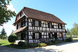 Farmhouse | |
show Location of Nancray | |
 Nancray | |
| Coordinates: 47°14′45″N 6°10′56″E / 47.2458°N 6.1822°ECoordinates: 47°14′45″N 6°10′56″E / 47.2458°N 6.1822°E | |
| Country | France |
| Region | Bourgogne-Franche-Comté |
| Department | Doubs |
| Arrondissement | Besançon |
| Canton | Besançon-5 |
| Intercommunality | Grand Besançon Métropole |
| Government | |
| • Mayor (2020–2026) | Vincent Fiétier |
| Area 1 | 16.48 km2 (6.36 sq mi) |
| Population (Jan. 2018)[1] | 1,258 |
| • Density | 76/km2 (200/sq mi) |
| Time zone | UTC+01:00 (CET) |
| • Summer (DST) | UTC+02:00 (CEST) |
| INSEE/Postal code | 25418 /25360 |
| Elevation | 395–561 m (1,296–1,841 ft) |
| 1 French Land Register data, which excludes lakes, ponds, glaciers > 1 km2 (0.386 sq mi or 247 acres) and river estuaries. | |


Nancray (French pronunciation: [nɑ̃kʁɛ]) is a commune in the Doubs department in the Bourgogne-Franche-Comté region in eastern France.
Geography[]
Nancray lies 15 km (9.3 mi) south of Roulans.
Population[]
| Year | Pop. | ±% |
|---|---|---|
| 1962 | 424 | — |
| 1968 | 504 | +18.9% |
| 1975 | 588 | +16.7% |
| 1982 | 779 | +32.5% |
| 1990 | 897 | +15.1% |
| 1999 | 1,017 | +13.4% |
| 2008 | 1,237 | +21.6% |
| 2012 | 1,268 | +2.5% |
See also[]
References[]
- ^ "Populations légales 2018". INSEE. 28 December 2020.
External links[]
| Wikimedia Commons has media related to Nancray. |
| show Authority control |
|---|
This Doubs geographical article is a stub. You can help Wikipedia by . |
Categories:
- Communes of Doubs
- Doubs geography stubs