Paroy, Doubs
Paroy | |
|---|---|
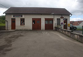 The town hall and school in Paroy | |
show Location of Paroy | |
 Paroy | |
| Coordinates: 47°02′38″N 5°52′56″E / 47.0439°N 5.8822°ECoordinates: 47°02′38″N 5°52′56″E / 47.0439°N 5.8822°E | |
| Country | France |
| Region | Bourgogne-Franche-Comté |
| Department | Doubs |
| Arrondissement | Besançon |
| Canton | Saint-Vit |
| Intercommunality | Loue-Lison |
| Government | |
| • Mayor (2020–2026) | Michel Chaussarot[1] |
| Area 1 | 4.37 km2 (1.69 sq mi) |
| Population (Jan. 2018)[2] | 125 |
| • Density | 29/km2 (74/sq mi) |
| Time zone | UTC+01:00 (CET) |
| • Summer (DST) | UTC+02:00 (CEST) |
| INSEE/Postal code | 25445 /25440 |
| Elevation | 276–572 m (906–1,877 ft) |
| 1 French Land Register data, which excludes lakes, ponds, glaciers > 1 km2 (0.386 sq mi or 247 acres) and river estuaries. | |


Paroy is a commune in the Doubs département in the Bourgogne-Franche-Comté region in eastern France.
Population[]
| Year | Pop. | ±% |
|---|---|---|
| 1962 | 62 | — |
| 1968 | 80 | +29.0% |
| 1975 | 83 | +3.8% |
| 1982 | 93 | +12.0% |
| 1990 | 85 | −8.6% |
| 1999 | 96 | +12.9% |
| 2008 | 113 | +17.7% |
| 2012 | 120 | +6.2% |
See also[]
References[]
- ^ "Répertoire national des élus: les maires". data.gouv.fr, Plateforme ouverte des données publiques françaises (in French). 2 December 2020.
- ^ "Populations légales 2018". INSEE. 28 December 2020.
| Wikimedia Commons has media related to Paroy (Doubs). |
This Doubs geographical article is a stub. You can help Wikipedia by . |
Categories:
- Communes of Doubs
- Doubs geography stubs