Plaisance, Gers
Plaisance (Plasença) | |
|---|---|
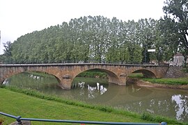 The bridge on the river Arros | |
 Coat of arms | |
show Location of Plaisance (Plasença) | |
 Plaisance (Plasença) | |
| Coordinates: 43°36′24″N 0°02′50″E / 43.6067°N 0.0472°ECoordinates: 43°36′24″N 0°02′50″E / 43.6067°N 0.0472°E | |
| Country | France |
| Region | Occitanie |
| Department | Gers |
| Arrondissement | Mirande |
| Canton | Pardiac-Rivière-Basse |
| Intercommunality | Bastides et vallons du Gers |
| Government | |
| • Mayor (2020–2026) | Patrick Fitan |
| Area 1 | 13.71 km2 (5.29 sq mi) |
| Population (Jan. 2018)[1] | 1,446 |
| • Density | 110/km2 (270/sq mi) |
| Time zone | UTC+01:00 (CET) |
| • Summer (DST) | UTC+02:00 (CEST) |
| INSEE/Postal code | 32319 /32160 |
| Elevation | 122–186 m (400–610 ft) (avg. 131 m or 430 ft) |
| 1 French Land Register data, which excludes lakes, ponds, glaciers > 1 km2 (0.386 sq mi or 247 acres) and river estuaries. | |


Plaisance (French pronunciation: [plɛzɑ̃s] (![]() listen); Gascon: Plasença) is a commune in the Gers department in southwestern France.
listen); Gascon: Plasença) is a commune in the Gers department in southwestern France.
Geography[]

Plaisance and its surrounding communes
Population[]
| Year | Pop. | ±% |
|---|---|---|
| 1962 | 1,490 | — |
| 1968 | 1,535 | +3.0% |
| 1975 | 1,576 | +2.7% |
| 1982 | 1,575 | −0.1% |
| 1990 | 1,657 | +5.2% |
| 1999 | 1,479 | −10.7% |
| 2008 | 1,465 | −0.9% |
| 2012 | 1,475 | +0.7% |
See also[]
- Communes of the Gers department
References[]
- ^ "Populations légales 2018". INSEE. 28 December 2020.
| Wikimedia Commons has media related to Plaisance (Gers). |
| show Communes of the Gers department |
|---|
This Gers geographical article is a stub. You can help Wikipedia by . |
Categories:
- Communes of Gers
- Gers geography stubs