Potte
From Wikipedia, the free encyclopedia
Commune in Hauts-de-France, France
Potte | |
|---|---|
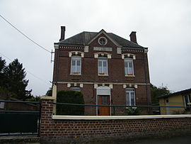 The town hall in Potte | |
 Coat of arms | |
 Potte  Potte | |
Coordinates:  49°47′54″N 2°54′10″E / 49.7983°N 2.9028°E / 49.7983; 2.9028Coordinates: 49°47′54″N 2°54′10″E / 49.7983°N 2.9028°E / 49.7983; 2.9028 49°47′54″N 2°54′10″E / 49.7983°N 2.9028°E / 49.7983; 2.9028Coordinates: 49°47′54″N 2°54′10″E / 49.7983°N 2.9028°E / 49.7983; 2.9028 | |
| Country | France |
| Region | Hauts-de-France |
| Department | Somme |
| Arrondissement | Péronne |
| Canton | Ham |
| Intercommunality | CC Est de la Somme |
| Government | |
| • Mayor (2020–2026) | Michel Merel[1] |
| Area 1 | 3.27 km2 (1.26 sq mi) |
| Population (Jan. 2018)[2] | 105 |
| • Density | 32/km2 (83/sq mi) |
| Time zone | UTC+01:00 (CET) |
| • Summer (DST) | UTC+02:00 (CEST) |
| INSEE/Postal code | 80638 /80190 |
| Elevation | 67–87 m (220–285 ft) (avg. 83 m or 272 ft) |
| 1 French Land Register data, which excludes lakes, ponds, glaciers > 1 km2 (0.386 sq mi or 247 acres) and river estuaries. | |

Potte is a commune in the Somme department in Hauts-de-France in northern France.
Contents
Geography[]
Potte is situated on the D139 and D35 crossroads, some 30 miles (48 km) east of Amiens.
Population[]
| Year | Pop. | ±% p.a. |
|---|---|---|
| 1968 | 91 | — |
| 1975 | 83 | −1.31% |
| 1982 | 84 | +0.17% |
| 1990 | 77 | −1.08% |
| 1999 | 84 | +0.97% |
| 2007 | 98 | +1.95% |
| 2012 | 117 | +3.61% |
| 2017 | 103 | −2.52% |
| Source: INSEE[3] | ||
See also[]
References[]
- ^ "Répertoire national des élus: les maires". data.gouv.fr, Plateforme ouverte des données publiques françaises (in French). 2 December 2020. Retrieved 7 December 2020.
- ^ "Populations légales 2018". INSEE. 28 December 2020.
- ^ Population en historique depuis 1968, INSEE
| Wikimedia Commons has media related to Potte. |
show
Communes of the Somme department | |
|---|---|
|
This Arrondissement of Péronne geographical article is a stub. You can help Wikipedia by . |
Retrieved from ""
Categories:
- Communes of Somme (department)
- Péronne arrondissement geography stubs
Hidden categories:
- CS1 French-language sources (fr)
- Articles with short description
- Short description is different from Wikidata
- Infobox mapframe without OSM relation ID on Wikidata
- Coordinates on Wikidata
- Pages using infobox settlement with image map1 but not image map
- Commons category link from Wikidata
- Articles with BNF identifiers
- All stub articles
- Pages using the Kartographer extension