Pouligney-Lusans
Pouligney-Lusans | |
|---|---|
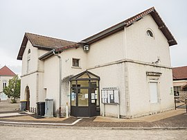 The town hall in Pouligney | |
show Location of Pouligney-Lusans | |
 Pouligney-Lusans | |
| Coordinates: 47°19′46″N 6°12′17″E / 47.3294°N 6.2047°ECoordinates: 47°19′46″N 6°12′17″E / 47.3294°N 6.2047°E | |
| Country | France |
| Region | Bourgogne-Franche-Comté |
| Department | Doubs |
| Arrondissement | Besançon |
| Canton | Baume-les-Dames |
| Government | |
| • Mayor (2020–2026) | François Heranney |
| Area 1 | 11.6 km2 (4.5 sq mi) |
| Population (Jan. 2018)[1] | 848 |
| • Density | 73/km2 (190/sq mi) |
| Time zone | UTC+01:00 (CET) |
| • Summer (DST) | UTC+02:00 (CEST) |
| INSEE/Postal code | 25468 /25640 |
| Elevation | 257–453 m (843–1,486 ft) |
| 1 French Land Register data, which excludes lakes, ponds, glaciers > 1 km2 (0.386 sq mi or 247 acres) and river estuaries. | |


Pouligney-Lusans (French pronunciation: [puliɲɛ lyzɑ̃]) is a commune in the Doubs department in the Bourgogne-Franche-Comté region in eastern France.
Geography[]
The commune lies 3 km (1.9 mi) north of Roulans.
Population[]
| Year | Pop. | ±% |
|---|---|---|
| 1962 | 261 | — |
| 1968 | 271 | +3.8% |
| 1975 | 326 | +20.3% |
| 1982 | 517 | +58.6% |
| 1990 | 625 | +20.9% |
| 1999 | 695 | +11.2% |
| 2008 | 759 | +9.2% |
| 2012 | 794 | +4.6% |
See also[]
References[]
- ^ "Populations légales 2018". INSEE. 28 December 2020.
External links[]
| Wikimedia Commons has media related to Pouligney-Lusans. |
This Doubs geographical article is a stub. You can help Wikipedia by . |
Categories:
- Communes of Doubs
- Doubs geography stubs