Saint-Maur, Gers
Saint-Maur | |
|---|---|
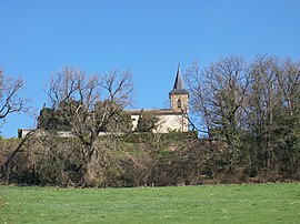 The church in Saint-Maur | |
show Location of Saint-Maur | |
 Saint-Maur | |
| Coordinates: 43°28′43″N 0°20′38″E / 43.4786°N 0.3439°ECoordinates: 43°28′43″N 0°20′38″E / 43.4786°N 0.3439°E | |
| Country | France |
| Region | Occitanie |
| Department | Gers |
| Arrondissement | Mirande |
| Canton | Mirande-Astarac |
| Intercommunality | Cœur d'Astarac en Gascogne |
| Government | |
| • Mayor (2020–2026) | Stéphane Bernard |
| Area 1 | 13.84 km2 (5.34 sq mi) |
| Population (Jan. 2018)[1] | 139 |
| • Density | 10/km2 (26/sq mi) |
| Time zone | UTC+01:00 (CET) |
| • Summer (DST) | UTC+02:00 (CEST) |
| INSEE/Postal code | 32393 /32300 |
| Elevation | 170–290 m (560–950 ft) (avg. 289 m or 948 ft) |
| 1 French Land Register data, which excludes lakes, ponds, glaciers > 1 km2 (0.386 sq mi or 247 acres) and river estuaries. | |


Saint-Maur (French pronunciation: [sɛ̃ moʁ] (![]() listen); Occitan: Sent Maur) is a commune in the Gers department in southwestern France.
listen); Occitan: Sent Maur) is a commune in the Gers department in southwestern France.
Geography[]
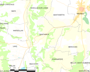
Saint-Maur and its surrounding communes
Population[]
| Year | Pop. | ±% |
|---|---|---|
| 1962 | 136 | — |
| 1968 | 132 | −2.9% |
| 1975 | 89 | −32.6% |
| 1982 | 111 | +24.7% |
| 1990 | 103 | −7.2% |
| 1999 | 111 | +7.8% |
| 2008 | 124 | +11.7% |
See also[]
- Communes of the Gers department
References[]
- ^ "Populations légales 2018". INSEE. 28 December 2020.
| Wikimedia Commons has media related to Saint-Maur (Gers). |
| show Communes of the Gers department |
|---|
This Gers geographical article is a stub. You can help Wikipedia by . |
Categories:
- Communes of Gers
- Gers geography stubs