Saint-Puy
Saint-Puy | |
|---|---|
 The church in Saint-Puy | |
 Coat of arms | |
show Location of Saint-Puy | |
 Saint-Puy | |
| Coordinates: 43°52′38″N 0°27′47″E / 43.8772°N 0.4631°ECoordinates: 43°52′38″N 0°27′47″E / 43.8772°N 0.4631°E | |
| Country | France |
| Region | Occitanie |
| Department | Gers |
| Arrondissement | Condom |
| Canton | Baïse-Armagnac |
| Government | |
| • Mayor (2020–2026) | Michel Labatut[1] |
| Area 1 | 36.88 km2 (14.24 sq mi) |
| Population (Jan. 2018)[2] | 593 |
| • Density | 16/km2 (42/sq mi) |
| Time zone | UTC+01:00 (CET) |
| • Summer (DST) | UTC+02:00 (CEST) |
| INSEE/Postal code | 32404 /32310 |
| Elevation | 87–220 m (285–722 ft) (avg. 160 m or 520 ft) |
| 1 French Land Register data, which excludes lakes, ponds, glaciers > 1 km2 (0.386 sq mi or 247 acres) and river estuaries. | |


Saint-Puy is a commune in the Gers department in southwestern France.
Geography[]
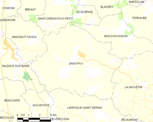
Saint-Puy and its surrounding communes
Population[]
| Year | Pop. | ±% |
|---|---|---|
| 1962 | 836 | — |
| 1968 | 748 | −10.5% |
| 1975 | 669 | −10.6% |
| 1982 | 601 | −10.2% |
| 1990 | 595 | −1.0% |
| 1999 | 603 | +1.3% |
| 2008 | 572 | −5.1% |
Notable people[]
Saint-Puy was the home of the gentleman soldier Blaise de Monluc.
See also[]
- Communes of the Gers department
References[]
- ^ "Répertoire national des élus: les maires". data.gouv.fr, Plateforme ouverte des données publiques françaises (in French). 2 December 2020.
- ^ "Populations légales 2018". INSEE. 28 December 2020.
| Wikimedia Commons has media related to Saint-Puy. |
| show Communes of the Gers department |
|---|
| show Authority control |
|---|
This Gers geographical article is a stub. You can help Wikipedia by . |
Categories:
- Communes of Gers
- Gers geography stubs