Sainte-Colombe, Doubs
Sainte-Colombe | |
|---|---|
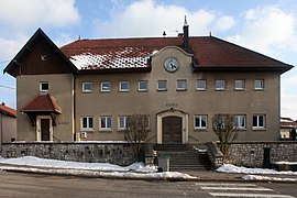 The town hall in Sainte-Colombe | |
show Location of Sainte-Colombe | |
 Sainte-Colombe | |
| Coordinates: 46°52′46″N 6°16′05″E / 46.8794°N 6.2681°ECoordinates: 46°52′46″N 6°16′05″E / 46.8794°N 6.2681°E | |
| Country | France |
| Region | Bourgogne-Franche-Comté |
| Department | Doubs |
| Arrondissement | Pontarlier |
| Canton | Pontarlier |
| Government | |
| • Mayor (2008–2014) | Alain Sirugue |
| Area 1 | 10.49 km2 (4.05 sq mi) |
| Population (Jan. 2018)[1] | 417 |
| • Density | 40/km2 (100/sq mi) |
| Time zone | UTC+01:00 (CET) |
| • Summer (DST) | UTC+02:00 (CEST) |
| INSEE/Postal code | 25515 /25300 |
| Elevation | 809–1,024 m (2,654–3,360 ft) |
| 1 French Land Register data, which excludes lakes, ponds, glaciers > 1 km2 (0.386 sq mi or 247 acres) and river estuaries. | |


Sainte-Colombe is a commune in the Doubs department in the Bourgogne-Franche-Comté region in eastern France.
Geography[]
The commune lies 7 km (4.3 mi) northeast of Pontarlier in the valley of the .
Population[]
| Year | Pop. | ±% |
|---|---|---|
| 1962 | 137 | — |
| 1968 | 152 | +10.9% |
| 1975 | 186 | +22.4% |
| 1982 | 224 | +20.4% |
| 1990 | 255 | +13.8% |
| 1999 | 232 | −9.0% |
| 2008 | 279 | +20.3% |
| 2012 | 361 | +29.4% |
Transportation[]
The commune has a railway station, Sainte-Colombe, on the Frasne–Les Verrières line.
See also[]
References[]
- ^ "Populations légales 2018". INSEE. 28 December 2020.
External links[]
| Wikimedia Commons has media related to Sainte-Colombe (Doubs). |
- Sainte-Colombe on the regional Web site (in French)
This Doubs geographical article is a stub. You can help Wikipedia by . |
Categories:
- Communes of Doubs
- Doubs geography stubs