Sansan, Gers
Sansan | |
|---|---|
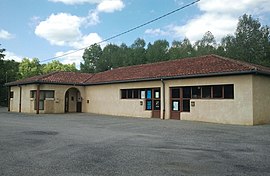 The town hall in Sansan | |
show Location of Sansan | |
 Sansan | |
| Coordinates: 43°31′53″N 0°36′30″E / 43.5314°N 0.6083°ECoordinates: 43°31′53″N 0°36′30″E / 43.5314°N 0.6083°E | |
| Country | France |
| Region | Occitanie |
| Department | Gers |
| Arrondissement | Mirande |
| Canton | Auch-3 |
| Government | |
| • Mayor (2020–2026) | Jacques Sonilhac |
| Area 1 | 3.7 km2 (1.4 sq mi) |
| Population (Jan. 2018)[1] | 101 |
| • Density | 27/km2 (71/sq mi) |
| Time zone | UTC+01:00 (CET) |
| • Summer (DST) | UTC+02:00 (CEST) |
| INSEE/Postal code | 32411 /32260 |
| Elevation | 159–240 m (522–787 ft) (avg. 166 m or 545 ft) |
| 1 French Land Register data, which excludes lakes, ponds, glaciers > 1 km2 (0.386 sq mi or 247 acres) and river estuaries. | |


Sansan (French pronunciation: [sɑ̃sɑ̃]) is a commune in the Gers department in southwestern France.
The vicinity of Sansan is known for its Miocene fossil deposits where geologist Edouard Lartet unearthed the jaw of the primate Pliopithecus antiquus in 1837.
Geography[]
Localisation[]
Sansan is located 14 km south of Auch and 4 km north of Seissan, along the Gers river.

Sansan and its surrounding communes
| show Places adjacent to Sansan, Gers |
|---|
Toponymy[]
Sansan finds its origin in the Latin patronymic name Sancianus or Santius, followed by the suffix -anum, designing a property of which a man by this name must have been the owner in the times of Roman Gaul.[2]
Population[]
| Year | Pop. | ±% |
|---|---|---|
| 1962 | 87 | — |
| 1968 | 90 | +3.4% |
| 1975 | 81 | −10.0% |
| 1982 | 98 | +21.0% |
| 1990 | 108 | +10.2% |
| 1999 | 89 | −17.6% |
| 2008 | 93 | +4.5% |
See also[]
- Communes of the Gers department
References[]
- ^ "Populations légales 2018". INSEE. 28 December 2020.
- ^ Valdegers.fr
| Wikimedia Commons has media related to Sansan. |
| show Communes of the Gers department |
|---|
| show Authority control |
|---|
This Gers geographical article is a stub. You can help Wikipedia by . |
Categories:
- Communes of Gers
- Paleontological sites of Europe
- Gers geography stubs