Saramon
Saramon | |
|---|---|
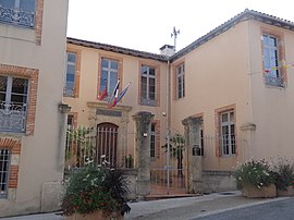 The town hall in Saramon | |
 Coat of arms | |
show Location of Saramon | |
 Saramon | |
| Coordinates: 43°31′25″N 0°45′54″E / 43.5236°N 0.765°ECoordinates: 43°31′25″N 0°45′54″E / 43.5236°N 0.765°E | |
| Country | France |
| Region | Occitanie |
| Department | Gers |
| Arrondissement | Auch |
| Canton | Astarac-Gimone |
| Government | |
| • Mayor (2020–2026) | Éric Balducci |
| Area 1 | 13.03 km2 (5.03 sq mi) |
| Population (Jan. 2018)[1] | 834 |
| • Density | 64/km2 (170/sq mi) |
| Time zone | UTC+01:00 (CET) |
| • Summer (DST) | UTC+02:00 (CEST) |
| INSEE/Postal code | 32412 /32450 |
| Elevation | 166–266 m (545–873 ft) (avg. 200 m or 660 ft) |
| 1 French Land Register data, which excludes lakes, ponds, glaciers > 1 km2 (0.386 sq mi or 247 acres) and river estuaries. | |


Saramon (French pronunciation: [saʁamɔ̃]) is a commune in the Gers department in southwestern France.
Geography[]

Saramon and its surrounding communes
Population[]
|
|
See also[]
- Communes of the Gers department
References[]
- ^ "Populations légales 2018". INSEE. 28 December 2020.
| Wikimedia Commons has media related to Saramon. |
| show Communes of the Gers department |
|---|
| show Authority control |
|---|
This Gers geographical article is a stub. You can help Wikipedia by . |
Categories:
- Communes of Gers
- Gers geography stubs