Thulay
Thulay | |
|---|---|
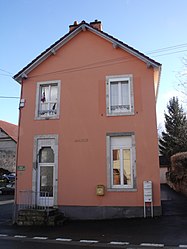 The town hall in Thulay | |
 Coat of arms | |
show Location of Thulay | |
 Thulay | |
| Coordinates: 47°25′30″N 6°51′44″E / 47.425°N 6.8622°ECoordinates: 47°25′30″N 6°51′44″E / 47.425°N 6.8622°E | |
| Country | France |
| Region | Bourgogne-Franche-Comté |
| Department | Doubs |
| Arrondissement | Montbéliard |
| Canton | Maîche |
| Intercommunality | Pays de Montbéliard Agglomération |
| Government | |
| • Mayor (2008–2014) | Rémi Lapprand |
| Area 1 | 2.23 km2 (0.86 sq mi) |
| Population (Jan. 2018)[1] | 214 |
| • Density | 96/km2 (250/sq mi) |
| Time zone | UTC+01:00 (CET) |
| • Summer (DST) | UTC+02:00 (CEST) |
| INSEE/Postal code | 25562 /25310 |
| Elevation | 394–541 m (1,293–1,775 ft) |
| 1 French Land Register data, which excludes lakes, ponds, glaciers > 1 km2 (0.386 sq mi or 247 acres) and river estuaries. | |


Thulay is a commune in the Doubs department in the Bourgogne-Franche-Comté region in eastern France.
Geography[]
Thulay lies 2.5 km (1.6 mi) from Hérimoncourt on the slope of the Blamont plateau.
Population[]
| Year | Pop. | ±% |
|---|---|---|
| 1962 | 93 | — |
| 1968 | 95 | +2.2% |
| 1975 | 105 | +10.5% |
| 1982 | 119 | +13.3% |
| 1990 | 140 | +17.6% |
| 1999 | 172 | +22.9% |
| 2008 | 231 | +34.3% |
| 2012 | 226 | −2.2% |
See also[]
References[]
- ^ "Populations légales 2018". INSEE. 28 December 2020.
External links[]
| Wikimedia Commons has media related to Thulay. |
- Thulay on the regional Web site (in French)
This Doubs geographical article is a stub. You can help Wikipedia by . |
Categories:
- Communes of Doubs
- Doubs geography stubs