Thurey-le-Mont
Thurey-le-Mont | |
|---|---|
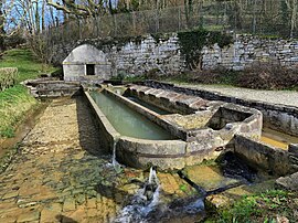 The wash house in Thurey-le-Mont | |
show Location of Thurey-le-Mont | |
 Thurey-le-Mont | |
| Coordinates: 47°22′24″N 6°07′27″E / 47.3733°N 6.1242°ECoordinates: 47°22′24″N 6°07′27″E / 47.3733°N 6.1242°E | |
| Country | France |
| Region | Bourgogne-Franche-Comté |
| Department | Doubs |
| Arrondissement | Besançon |
| Canton | Baume-les-Dames |
| Government | |
| • Mayor (2020–2026) | Jean-Paul Faivre[1] |
| Area 1 | 4.83 km2 (1.86 sq mi) |
| Population (Jan. 2018)[2] | 126 |
| • Density | 26/km2 (68/sq mi) |
| Time zone | UTC+01:00 (CET) |
| • Summer (DST) | UTC+02:00 (CEST) |
| INSEE/Postal code | 25563 /25870 |
| Elevation | 218–283 m (715–928 ft) |
| 1 French Land Register data, which excludes lakes, ponds, glaciers > 1 km2 (0.386 sq mi or 247 acres) and river estuaries. | |


Thurey-le-Mont is a commune in the Doubs department in the Bourgogne-Franche-Comté region in eastern France.
Geography[]
The commune lies 9 km (5.6 mi) north of Marchaux above the valley of the Ognon. Half of its territory is covered by forest.
Population[]
| Year | Pop. | ±% |
|---|---|---|
| 1962 | 49 | — |
| 1968 | 56 | +14.3% |
| 1975 | 64 | +14.3% |
| 1982 | 94 | +46.9% |
| 1990 | 100 | +6.4% |
| 1999 | 106 | +6.0% |
| 2008 | 110 | +3.8% |
| 2012 | 109 | −0.9% |
See also[]
References[]
- ^ "Répertoire national des élus: les maires". data.gouv.fr, Plateforme ouverte des données publiques françaises (in French). 2 December 2020.
- ^ "Populations légales 2018". INSEE. 28 December 2020.
External links[]
| Wikimedia Commons has media related to Thurey-le-Mont. |
- Thurey-le-Mont on the regional Web site (in French)
This Doubs geographical article is a stub. You can help Wikipedia by . |
Categories:
- Communes of Doubs
- Doubs geography stubs