Troncens
Troncens | |
|---|---|
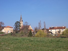 A general view of Troncens | |
show Location of Troncens | |
 Troncens | |
| Coordinates: 43°27′41″N 0°12′57″E / 43.4614°N 0.2158°ECoordinates: 43°27′41″N 0°12′57″E / 43.4614°N 0.2158°E | |
| Country | France |
| Region | Occitanie |
| Department | Gers |
| Arrondissement | Mirande |
| Canton | Pardiac-Rivière-Basse |
| Intercommunality | Bastides et vallons du Gers |
| Government | |
| • Mayor (2020–2026) | Francis Daguzan[1] |
| Area 1 | 12.97 km2 (5.01 sq mi) |
| Population (Jan. 2018)[2] | 183 |
| • Density | 14/km2 (37/sq mi) |
| Time zone | UTC+01:00 (CET) |
| • Summer (DST) | UTC+02:00 (CEST) |
| INSEE/Postal code | 32455 /32230 |
| Elevation | 182–342 m (597–1,122 ft) (avg. 150 m or 490 ft) |
| 1 French Land Register data, which excludes lakes, ponds, glaciers > 1 km2 (0.386 sq mi or 247 acres) and river estuaries. | |


Troncens is a commune in the Gers department of Gascony in the southwestern France.
Geography[]
Localisation[]
Troncens is situated in the south of the department near the department of Hautes-Pyrenees.

Troncens and its surrounding communes
Hydrography[]
The , right tributary of the Bouès, has its source in the town. Another tributary (left bank) of the Bouès, the , runs through the town. The farms are dispersed throughout the area.
Population[]
| Year | Pop. | ±% |
|---|---|---|
| 522 | 1,818 | — |
| 416 | 1,848 | +1.7% |
| 652 | 1,896 | +2.6% |
| 429 | 1,912 | +0.8% |
| 402 | 1,947 | +1.8% |
| 278 | 1,962 | +0.8% |
| 219 | 1,968 | +0.3% |
| 198 | 1,975 | +0.4% |
| 197 | 1,982 | +0.4% |
| 206 | 1,990 | +0.4% |
| 206 | 1,999 | +0.5% |
| 199 | 2,008 | +0.5% |
| 184 | — |
Businesses and artisans[]
- Agriculture: sunflower, corn
- 1 gîte: CAP de BOUEOU (bouéou = beef in Gascon dialect) - Vacation rental in an 18th-century farmhouse in Troncens, Gers.
See also[]
- Communes of the Gers department
References[]
- ^ "Répertoire national des élus: les maires". data.gouv.fr, Plateforme ouverte des données publiques françaises (in French). 2 December 2020.
- ^ "Populations légales 2018". INSEE. 28 December 2020.
| Wikimedia Commons has media related to Troncens. |
| show Communes of the Gers department |
|---|
This Gers geographical article is a stub. You can help Wikipedia by . |
Categories:
- Communes of Gers
- Gers geography stubs