La Bazoche-Gouet
La Bazoche-Gouet | |
|---|---|
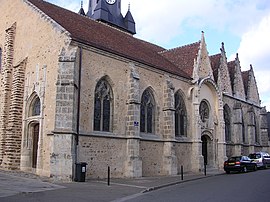 The church in La Bazoche-Gouet | |
 Coat of arms | |
show Location of La Bazoche-Gouet | |
 La Bazoche-Gouet | |
| Coordinates: 48°08′22″N 0°58′53″E / 48.1394°N 0.9814°ECoordinates: 48°08′22″N 0°58′53″E / 48.1394°N 0.9814°E | |
| Country | France |
| Region | Centre-Val de Loire |
| Department | Eure-et-Loir |
| Arrondissement | Nogent-le-Rotrou |
| Canton | Brou |
| Intercommunality | Grand Châteaudun |
| Government | |
| • Mayor (2008–2014) | Dominique Béranger |
| Area 1 | 37.44 km2 (14.46 sq mi) |
| Population (Jan. 2018)[1] | 1,220 |
| • Density | 33/km2 (84/sq mi) |
| Time zone | UTC+01:00 (CET) |
| • Summer (DST) | UTC+02:00 (CEST) |
| INSEE/Postal code | 28027 /28330 |
| Elevation | 164–229 m (538–751 ft) (avg. 196 m or 643 ft) |
| 1 French Land Register data, which excludes lakes, ponds, glaciers > 1 km2 (0.386 sq mi or 247 acres) and river estuaries. | |


La Bazoche-Gouet is a commune in the Eure-et-Loir department in northern France.
Population[]
| Year | Pop. | ±% |
|---|---|---|
| 1962 | 1,463 | — |
| 1968 | 1,529 | +4.5% |
| 1975 | 1,451 | −5.1% |
| 1982 | 1,311 | −9.6% |
| 1990 | 1,281 | −2.3% |
| 1999 | 1,249 | −2.5% |
| 2008 | 1,310 | +4.9% |
See also[]
- Communes of the Eure-et-Loir department
References[]
- ^ "Populations légales 2018". INSEE. 28 December 2020.
| Wikimedia Commons has media related to La Bazoche-Gouet. |
| show Communes of the Eure-et-Loir department of France |
|---|
| show Authority control |
|---|
This Eure-et-Loir geographical article is a stub. You can help Wikipedia by . |
Categories:
- Communes of Eure-et-Loir
- Eure-et-Loir geography stubs