La Loupe
La Loupe | |
|---|---|
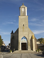 The church in La Loupe | |
 Coat of arms | |
show Location of La Loupe | |
 La Loupe | |
| Coordinates: 48°28′21″N 1°00′57″E / 48.4725°N 1.0158°ECoordinates: 48°28′21″N 1°00′57″E / 48.4725°N 1.0158°E | |
| Country | France |
| Region | Centre-Val de Loire |
| Department | Eure-et-Loir |
| Arrondissement | Nogent-le-Rotrou |
| Canton | Nogent-le-Rotrou |
| Government | |
| • Mayor (2020–2026) | Eric Gérard[1] |
| Area 1 | 7.27 km2 (2.81 sq mi) |
| Population (Jan. 2018)[2] | 3,334 |
| • Density | 460/km2 (1,200/sq mi) |
| Time zone | UTC+01:00 (CET) |
| • Summer (DST) | UTC+02:00 (CEST) |
| INSEE/Postal code | 28214 /28240 |
| Elevation | 192–243 m (630–797 ft) |
| 1 French Land Register data, which excludes lakes, ponds, glaciers > 1 km2 (0.386 sq mi or 247 acres) and river estuaries. | |


La Loupe is a commune in the Eure-et-Loir department in northern France.
Population[]
| Year | Pop. | ±% |
|---|---|---|
| 1962 | 2,737 | — |
| 1968 | 3,510 | +28.2% |
| 1975 | 3,719 | +6.0% |
| 1982 | 3,693 | −0.7% |
| 1990 | 3,820 | +3.4% |
| 1999 | 3,734 | −2.3% |
| 2008 | 3,465 | −7.2% |
Sister city[]
 Pfalzgrafenweiler, Germany
 Royston in Hertfordshire, England
See also[]
- Communes of the Eure-et-Loir department
- Perche
References[]
- ^ "Répertoire national des élus: les maires". data.gouv.fr, Plateforme ouverte des données publiques françaises (in French). 2 December 2020.
- ^ "Populations légales 2018". INSEE. 28 December 2020.
| Wikimedia Commons has media related to La Loupe. |
| show Communes of the Eure-et-Loir department of France |
|---|
| show Authority control |
|---|
This Eure-et-Loir geographical article is a stub. You can help Wikipedia by . |
Categories:
- Communes of Eure-et-Loir
- Perche
- Eure-et-Loir geography stubs