Luisant
Luisant | |
|---|---|
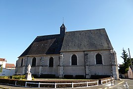 The church in Luisant | |
 Coat of arms | |
show Location of Luisant | |
 Luisant | |
| Coordinates: 48°25′57″N 1°28′38″E / 48.4325°N 1.4772°ECoordinates: 48°25′57″N 1°28′38″E / 48.4325°N 1.4772°E | |
| Country | France |
| Region | Centre-Val de Loire |
| Department | Eure-et-Loir |
| Arrondissement | Chartres |
| Canton | Lucé |
| Intercommunality | CA Chartres Métropole |
| Government | |
| • Mayor (2020–2026) | Bertrand Massot |
| Area 1 | 4.43 km2 (1.71 sq mi) |
| Population (Jan. 2018)[1] | 6,673 |
| • Density | 1,500/km2 (3,900/sq mi) |
| Time zone | UTC+01:00 (CET) |
| • Summer (DST) | UTC+02:00 (CEST) |
| INSEE/Postal code | 28220 /28600 |
| Elevation | 125–158 m (410–518 ft) (avg. 75 m or 246 ft) |
| 1 French Land Register data, which excludes lakes, ponds, glaciers > 1 km2 (0.386 sq mi or 247 acres) and river estuaries. | |


Luisant (French pronunciation: [lɥizɑ̃]) is a commune in the Eure-et-Loir department in northern France.
Population[]
| Year | Pop. | ±% |
|---|---|---|
| 1830 | 700 | — |
| 1914 | 1,190 | +70.0% |
| 1946 | 1,720 | +44.5% |
| 1962 | 3,063 | +78.1% |
| 1968 | 3,491 | +14.0% |
| 1975 | 4,950 | +41.8% |
| 1982 | 5,435 | +9.8% |
| 1990 | 6,449 | +18.7% |
| 1999 | 6,622 | +2.7% |
| 2008 | 6,858 | +3.6% |
Twin towns[]
Luisant is twinned with:
 Hochstadt, Germany, since 1974
 Villanueva del Pardillo, Spain, since 2002
 Chions, Italy, since 2002
See also[]
- Communes of the Eure-et-Loir department
References[]
- ^ "Populations légales 2018". INSEE. 28 December 2020.
External links[]
| Wikimedia Commons has media related to Luisant. |
| show Communes of the Eure-et-Loir department of France |
|---|
| show Authority control |
|---|
This Eure-et-Loir geographical article is a stub. You can help Wikipedia by . |
Categories:
- Communes of Eure-et-Loir
- Eure-et-Loir geography stubs