Magny, Eure-et-Loir
Magny | |
|---|---|
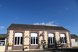 The town hall in Magny | |
 Coat of arms | |
show Location of Magny | |
 Magny | |
| Coordinates: 48°21′00″N 1°15′50″E / 48.35°N 1.2639°ECoordinates: 48°21′00″N 1°15′50″E / 48.35°N 1.2639°E | |
| Country | France |
| Region | Centre-Val de Loire |
| Department | Eure-et-Loir |
| Arrondissement | Chartres |
| Canton | Illiers-Combray |
| Intercommunality | Entre Beauce et Perche |
| Government | |
| • Mayor (2008–2014) | Jean-François Manceau |
| Area 1 | 13.03 km2 (5.03 sq mi) |
| Population (Jan. 2018)[1] | 649 |
| • Density | 50/km2 (130/sq mi) |
| Time zone | UTC+01:00 (CET) |
| • Summer (DST) | UTC+02:00 (CEST) |
| INSEE/Postal code | 28225 /28120 |
| Elevation | 159–192 m (522–630 ft) (avg. 172 m or 564 ft) |
| 1 French Land Register data, which excludes lakes, ponds, glaciers > 1 km2 (0.386 sq mi or 247 acres) and river estuaries. | |


Magny is a commune in the Eure-et-Loir department in northern France.
Population[]
|
|
See also[]
- Communes of the Eure-et-Loir department
References[]
- ^ "Populations légales 2018". INSEE. 28 December 2020.
| Wikimedia Commons has media related to Magny (Eure-et-Loir). |
| show Communes of the Eure-et-Loir department of France |
|---|
This Eure-et-Loir geographical article is a stub. You can help Wikipedia by . |
Categories:
- Communes of Eure-et-Loir
- Eure-et-Loir geography stubs