Pierres, Eure-et-Loir
Pierres | |
|---|---|
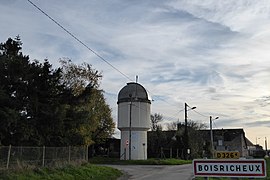 The Boisricheux Observatory in Pierres | |
show Location of Pierres | |
 Pierres | |
| Coordinates: 48°35′31″N 1°34′04″E / 48.5919°N 1.5678°ECoordinates: 48°35′31″N 1°34′04″E / 48.5919°N 1.5678°E | |
| Country | France |
| Region | Centre-Val de Loire |
| Department | Eure-et-Loir |
| Arrondissement | Chartres |
| Canton | Épernon |
| Government | |
| • Mayor (2020–2026) | Daniel Morin[1] |
| Area 1 | 10.41 km2 (4.02 sq mi) |
| Population (Jan. 2018)[2] | 2,769 |
| • Density | 270/km2 (690/sq mi) |
| Time zone | UTC+01:00 (CET) |
| • Summer (DST) | UTC+02:00 (CEST) |
| INSEE/Postal code | 28298 /28130 |
| Elevation | 95–159 m (312–522 ft) (avg. 102 m or 335 ft) |
| 1 French Land Register data, which excludes lakes, ponds, glaciers > 1 km2 (0.386 sq mi or 247 acres) and river estuaries. | |


Pierres (French pronunciation: [pjɛʁ] (![]() listen)) is a commune in the Eure-et-Loir department in northern France.
listen)) is a commune in the Eure-et-Loir department in northern France.
With the neighbouring commune of Maintenon, they form an urban satellite of Paris of 7,131 inhabitants (1999 census).
Population[]
| Year | Pop. | ±% |
|---|---|---|
| 1962 | 837 | — |
| 1968 | 853 | +1.9% |
| 1975 | 1,301 | +52.5% |
| 1982 | 1,965 | +51.0% |
| 1990 | 2,398 | +22.0% |
| 1999 | 2,691 | +12.2% |
| 2008 | 2,715 | +0.9% |
See also[]
- Communes of the Eure-et-Loir department
References[]
- ^ "Répertoire national des élus: les maires". data.gouv.fr, Plateforme ouverte des données publiques françaises (in French). 2 December 2020. Retrieved 7 December 2020.
- ^ "Populations légales 2018". INSEE. 28 December 2020.
| Wikimedia Commons has media related to Pierres (Eure-et-Loir). |
| show Communes of the Eure-et-Loir department of France |
|---|
| show Authority control |
|---|
This Eure-et-Loir geographical article is a stub. You can help Wikipedia by . |
Categories:
- Communes of Eure-et-Loir
- Eure-et-Loir geography stubs