Saint-Suliac
Saint-Suliac
Sant-Suliav | |
|---|---|
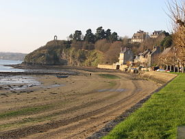 The shore of Saint-Suliac | |
 Coat of arms | |
show Location of Saint-Suliac | |
 Saint-Suliac | |
| Coordinates: 48°34′15″N 1°58′17″W / 48.5708°N 1.9714°WCoordinates: 48°34′15″N 1°58′17″W / 48.5708°N 1.9714°W | |
| Country | France |
| Region | Brittany |
| Department | Ille-et-Vilaine |
| Arrondissement | Saint-Malo |
| Canton | Dol-de-Bretagne |
| Intercommunality | CA Pays de Saint-Malo |
| Government | |
| • Mayor (2020–2026) | Pascal Bianco[1] |
| Area 1 | 5.46 km2 (2.11 sq mi) |
| Population (Jan. 2018)[2] | 925 |
| • Density | 170/km2 (440/sq mi) |
| Time zone | UTC+01:00 (CET) |
| • Summer (DST) | UTC+02:00 (CEST) |
| INSEE/Postal code | 35314 /35430 |
| Elevation | 0–73 m (0–240 ft) |
| 1 French Land Register data, which excludes lakes, ponds, glaciers > 1 km2 (0.386 sq mi or 247 acres) and river estuaries. | |


Saint-Suliac (French pronunciation: [sɛ̃ syljak]; Breton: Sant-Suliav; Gallo: Saent-Suliau) is a commune in the Ille-et-Vilaine department in Brittany in northwestern France.
Population[]
Inhabitants of Saint-Suliac are called Suliaçais in French.
| Year | Pop. | ±% |
|---|---|---|
| 1962 | 545 | — |
| 1968 | 610 | +11.9% |
| 1975 | 614 | +0.7% |
| 1982 | 768 | +25.1% |
| 1990 | 802 | +4.4% |
| 1999 | 853 | +6.4% |
| 2009 | 937 | +9.8% |
See also[]
- Communes of the Ille-et-Vilaine department
References[]
- ^ "Répertoire national des élus: les maires". data.gouv.fr, Plateforme ouverte des données publiques françaises (in French). 2 December 2020.
- ^ "Populations légales 2018". INSEE. 28 December 2020.
External links[]
| Wikimedia Commons has media related to Saint-Suliac. |
- Base Mérimée: Search for heritage in the commune, Ministère français de la Culture. (in French)
- Mayors of Ille-et-Vilaine Association (in French)
| show Communes of the Ille-et-Vilaine department |
|---|
| show Villages in the association Les Plus Beaux Villages de France |
|---|
| show Authority control |
|---|
This Ille-et-Vilaine geographical article is a stub. You can help Wikipedia by . |
Categories:
- Communes of Ille-et-Vilaine
- Plus Beaux Villages de France
- Ille-et-Vilaine geography stubs