Soulaires
Soulaires | |
|---|---|
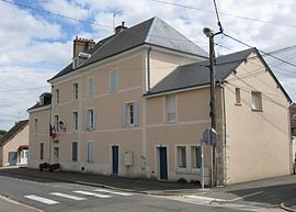 The town hall in Soulaires | |
show Location of Soulaires | |
 Soulaires | |
| Coordinates: 48°31′03″N 1°35′17″E / 48.5175°N 1.5881°ECoordinates: 48°31′03″N 1°35′17″E / 48.5175°N 1.5881°E | |
| Country | France |
| Region | Centre-Val de Loire |
| Department | Eure-et-Loir |
| Arrondissement | Chartres |
| Canton | Épernon |
| Government | |
| • Mayor (2020–2026) | Marc Molet[1] |
| Area 1 | 5.87 km2 (2.27 sq mi) |
| Population (Jan. 2018)[2] | 461 |
| • Density | 79/km2 (200/sq mi) |
| Time zone | UTC+01:00 (CET) |
| • Summer (DST) | UTC+02:00 (CEST) |
| INSEE/Postal code | 28379 /28130 |
| Elevation | 106–157 m (348–515 ft) (avg. 148 m or 486 ft) |
| 1 French Land Register data, which excludes lakes, ponds, glaciers > 1 km2 (0.386 sq mi or 247 acres) and river estuaries. | |


Soulaires (French pronunciation: [sulɛʁ]) is a commune in the Eure-et-Loir department in northern France.
Population[]
|
|
See also[]
- Communes of the Eure-et-Loir department
References[]
- ^ "Répertoire national des élus: les maires". data.gouv.fr, Plateforme ouverte des données publiques françaises (in French). 2 December 2020.
- ^ "Populations légales 2018". INSEE. 28 December 2020.
| Wikimedia Commons has media related to Soulaires. |
| show Communes of the Eure-et-Loir department of France |
|---|
| show Authority control |
|---|
This Eure-et-Loir geographical article is a stub. You can help Wikipedia by . |
Categories:
- Communes of Eure-et-Loir
- Eure-et-Loir geography stubs