Gargilesse-Dampierre
Gargilesse-Dampierre | |
|---|---|
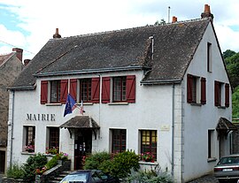 The town hall in Gargilesse | |
show Location of Gargilesse-Dampierre | |
 Gargilesse-Dampierre | |
| Coordinates: 46°30′52″N 1°35′52″E / 46.5144°N 1.5978°ECoordinates: 46°30′52″N 1°35′52″E / 46.5144°N 1.5978°E | |
| Country | France |
| Region | Centre-Val de Loire |
| Department | Indre |
| Arrondissement | Châteauroux |
| Canton | Argenton-sur-Creuse |
| Government | |
| • Mayor (2021–2026) | Martine Sabroux-Idoux[1] |
| Area 1 | 15.72 km2 (6.07 sq mi) |
| Population (Jan. 2018)[2] | 283 |
| • Density | 18/km2 (47/sq mi) |
| Time zone | UTC+01:00 (CET) |
| • Summer (DST) | UTC+02:00 (CEST) |
| INSEE/Postal code | 36081 /36190 |
| Elevation | 124–275 m (407–902 ft) (avg. 221 m or 725 ft) |
| 1 French Land Register data, which excludes lakes, ponds, glaciers > 1 km2 (0.386 sq mi or 247 acres) and river estuaries. | |


Gargilesse-Dampierre is a commune in the Indre department in central France.
It is classified as one of "The most beautiful villages of France" and is situated near the confluence of the Gargilesse stream and the river Creuse. The 19th century writer George Sand lived in the village.
Population[]
|
|
See also[]
- Communes of the Indre department
References[]
- ^ "Répertoire national des élus: les maires". data.gouv.fr, Plateforme ouverte des données publiques françaises (in French). 9 August 2021.
- ^ "Populations légales 2018". INSEE. 28 December 2020.
| Wikimedia Commons has media related to Gargilesse-Dampierre. |
| show Communes of the Indre department |
|---|
| show Villages in the association Les Plus Beaux Villages de France |
|---|
| show Authority control |
|---|
This Indre geographical article is a stub. You can help Wikipedia by . |
Categories:
- Communes of Indre
- Plus Beaux Villages de France
- Indre geography stubs