Bérelles
Bérelles | |
|---|---|
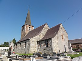 The church in Bérelles | |
 Coat of arms | |
show Location of Bérelles | |
 Bérelles | |
| Coordinates: 50°12′59″N 4°05′55″E / 50.2164°N 4.0986°ECoordinates: 50°12′59″N 4°05′55″E / 50.2164°N 4.0986°E | |
| Country | France |
| Region | Hauts-de-France |
| Department | Nord |
| Arrondissement | Avesnes-sur-Helpe |
| Canton | Fourmies |
| Intercommunality | |
| Government | |
| • Mayor (2014-2020) | Géraldine Traën |
| Area 1 | 5.78 km2 (2.23 sq mi) |
| Population (Jan. 2018)[1] | 151 |
| • Density | 26/km2 (68/sq mi) |
| Time zone | UTC+01:00 (CET) |
| • Summer (DST) | UTC+02:00 (CEST) |
| INSEE/Postal code | 59066 /59740 |
| Elevation | 168–229 m (551–751 ft) (avg. 150 m or 490 ft) |
| 1 French Land Register data, which excludes lakes, ponds, glaciers > 1 km2 (0.386 sq mi or 247 acres) and river estuaries. | |


Bérelles is a commune in the Nord department in northern France.
Population[]
| Year | Pop. | ±% |
|---|---|---|
| 1793 | 129 | — |
| 1800 | 114 | −11.6% |
| 1806 | 120 | +5.3% |
| 1821 | 226 | +88.3% |
| 1831 | 223 | −1.3% |
| 1836 | 245 | +9.9% |
| 1841 | 228 | −6.9% |
| 1846 | 232 | +1.8% |
| 1851 | 210 | −9.5% |
| 1856 | 198 | −5.7% |
| 1861 | 194 | −2.0% |
| 1866 | 200 | +3.1% |
| 1872 | 189 | −5.5% |
| 1876 | 184 | −2.6% |
| 1881 | 187 | +1.6% |
| 1886 | 176 | −5.9% |
| 1891 | 181 | +2.8% |
| 1896 | 167 | −7.7% |
| 1901 | 164 | −1.8% |
| 1906 | 194 | +18.3% |
| 1911 | 180 | −7.2% |
| 1921 | 180 | +0.0% |
| 1926 | 202 | +12.2% |
| 1931 | 200 | −1.0% |
| 1936 | 193 | −3.5% |
| 1946 | 157 | −18.7% |
| 1954 | 196 | +24.8% |
| 1962 | 207 | +5.6% |
| 1968 | 165 | −20.3% |
| 1975 | 167 | +1.2% |
| 1982 | 144 | −13.8% |
| 1990 | 151 | +4.9% |
| 1999 | 156 | +3.3% |
| 2005 | 155 | −0.6% |
| 2006 | 157 | +1.3% |
| 2009 | 163 | +3.8% |
| 2010 | 165 | +1.2% |
| 2015 | 148 | −10.3% |
Heraldry[]
 |
The arms of Bérelles are blazoned : Gules, in saltire 5 fleurs de lys.
|
See also[]
References[]
- ^ "Populations légales 2018". INSEE. 28 December 2020.
| Wikimedia Commons has media related to Bérelles. |
| Authority control |
|
|---|
This Nord geographical article is a stub. You can help Wikipedia by . |
Categories:
- Communes of Nord (French department)
- Nord (French department) geography stubs