Saint-Martin-sur-Écaillon
Saint-Martin-sur-Écaillon | |
|---|---|
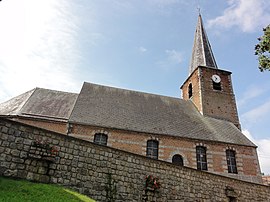 The church in Saint-Martin-sur-Écaillon | |
 Coat of arms | |
show Location of Saint-Martin-sur-Écaillon | |
 Saint-Martin-sur-Écaillon | |
| Coordinates: 50°14′57″N 3°31′42″E / 50.2492°N 3.5283°ECoordinates: 50°14′57″N 3°31′42″E / 50.2492°N 3.5283°E | |
| Country | France |
| Region | Hauts-de-France |
| Department | Nord |
| Arrondissement | Cambrai |
| Canton | Caudry |
| Intercommunality | |
| Government | |
| • Mayor (2020-2026) | Michel Dhaneus |
| Area 1 | 5.3 km2 (2.0 sq mi) |
| Population (Jan. 2018)[1] | 510 |
| • Density | 96/km2 (250/sq mi) |
| Time zone | UTC+01:00 (CET) |
| • Summer (DST) | UTC+02:00 (CEST) |
| INSEE/Postal code | 59537 /59213 |
| Elevation | 48–103 m (157–338 ft) (avg. 10 m or 33 ft) |
| 1 French Land Register data, which excludes lakes, ponds, glaciers > 1 km2 (0.386 sq mi or 247 acres) and river estuaries. | |


Saint-Martin-sur-Écaillon is a commune in the Nord department in northern France.
Heraldry[]
 |
The arms of Saint-Martin-sur-Écaillon are blazoned : Gules, semy of coronels argent. (this is an antique lance head that looks like a crown)
|
See also[]
References[]
- ^ "Populations légales 2018". INSEE. 28 December 2020.
| Wikimedia Commons has media related to Saint-Martin-sur-Écaillon. |
| show Authority control |
|---|
This Nord geographical article is a stub. You can help Wikipedia by . |
Categories:
- Communes of Nord (French department)
- Nord (French department) geography stubs