Gommegnies
Gommegnies | |
|---|---|
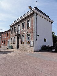 The town hall in Gommegnies | |
 Coat of arms | |
show Location of Gommegnies | |
 Gommegnies | |
| Coordinates: 50°16′18″N 3°42′21″E / 50.271596°N 3.705856°ECoordinates: 50°16′18″N 3°42′21″E / 50.271596°N 3.705856°E | |
| Country | France |
| Region | Hauts-de-France |
| Department | Nord |
| Arrondissement | Avesnes-sur-Helpe |
| Canton | Aulnoye-Aymeries |
| Intercommunality | |
| Government | |
| • Mayor (2014-2020) | Jean-Yves Fiérain |
| Area 1 | 15.78 km2 (6.09 sq mi) |
| Population (Jan. 2018)[1] | 2,312 |
| • Density | 150/km2 (380/sq mi) |
| Time zone | UTC+01:00 (CET) |
| • Summer (DST) | UTC+02:00 (CEST) |
| INSEE/Postal code | 59265 /59144 |
| Elevation | 100–152 m (328–499 ft) (avg. 124 m or 407 ft) |
| 1 French Land Register data, which excludes lakes, ponds, glaciers > 1 km2 (0.386 sq mi or 247 acres) and river estuaries. | |


Gommegnies is a commune in the Nord department in northern France.
Heraldry[]
 |
The arms of Gommegnies are blazoned : Gules, a fess and in chief a vivre Or. [a vivre is a thin barrulet dancetty] (Gommegnies, Hornaing and Mastaing use the same arms.)
|
See also[]
References[]
- ^ "Populations légales 2018". INSEE. 28 December 2020.
| Wikimedia Commons has media related to Gommegnies. |
| show Authority control |
|---|
This Nord geographical article is a stub. You can help Wikipedia by . |
Categories:
- Communes of Nord (French department)
- Nord (French department) geography stubs