Nieurlet
Nieurlet
Nieuwerleet | |
|---|---|
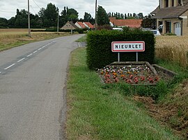 The road into Nieurlet | |
 Coat of arms | |
show Location of Nieurlet | |
 Nieurlet | |
| Coordinates: 50°47′24″N 2°16′59″E / 50.79°N 2.2831°ECoordinates: 50°47′24″N 2°16′59″E / 50.79°N 2.2831°E | |
| Country | France |
| Region | Hauts-de-France |
| Department | Nord |
| Arrondissement | Dunkerque |
| Canton | Wormhout |
| Intercommunality | Communauté de communes des Hauts de Flandre |
| Government | |
| • Mayor (2014-2020) | Dominique Marquis |
| Area 1 | 10.25 km2 (3.96 sq mi) |
| Population (Jan. 2018)[1] | 927 |
| • Density | 90/km2 (230/sq mi) |
| Demonym(s) | Nieurletois |
| Time zone | UTC+01:00 (CET) |
| • Summer (DST) | UTC+02:00 (CEST) |
| INSEE/Postal code | 59433 /59143 |
| Elevation | 0–28 m (0–92 ft) (avg. 13 m or 43 ft) |
| 1 French Land Register data, which excludes lakes, ponds, glaciers > 1 km2 (0.386 sq mi or 247 acres) and river estuaries. | |


Nieurlet (from Flemish; Nieuwerleet in modern Dutch spelling) is a commune in the Nord department in northern France.
Politics[]
Presidential Elections 2nd Round[]
| Election | Winning Candidate | Party | % | |
|---|---|---|---|---|
| 2017 | Marine Le Pen | FN | 57.36 | |
| 2012 | François Hollande | PS | 54.23 | |
| 2007 | Ségolène Royal | PS | 52.70 | |
| 2002 | Jacques Chirac | RPR | 76.06 | |
Heraldry[]
 |
The arms of Nieurlet are blazoned : Vairy Or and azure. (Beaurain, Nieurlet and Vendegies-au-Bois use the same arms.)
|
See also[]
References[]
- ^ "Populations légales 2018". INSEE. 28 December 2020.
- ^ http://www.lemonde.fr/data/france/presidentielle-2017//
| Wikimedia Commons has media related to Nieurlet. |
This Nord geographical article is a stub. You can help Wikipedia by . |
Categories:
- Communes of Nord (French department)
- Nord (French department) geography stubs