Beaumont-en-Cambrésis
Beaumont-en-Cambrésis | |
|---|---|
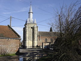 Saint-Laurent church | |
 Coat of arms | |
show Location of Beaumont-en-Cambrésis | |
 Beaumont-en-Cambrésis | |
| Coordinates: 50°07′25″N 3°27′19″E / 50.1236°N 3.4553°ECoordinates: 50°07′25″N 3°27′19″E / 50.1236°N 3.4553°E | |
| Country | France |
| Region | Hauts-de-France |
| Department | Nord |
| Arrondissement | Cambrai |
| Canton | Le Cateau-Cambrésis |
| Intercommunality | |
| Government | |
| • Mayor (2020–2026) | Fabrice Baccout[1] |
| Area 1 | 3.31 km2 (1.28 sq mi) |
| Population (Jan. 2018)[2] | 445 |
| • Density | 130/km2 (350/sq mi) |
| Time zone | UTC+01:00 (CET) |
| • Summer (DST) | UTC+02:00 (CEST) |
| INSEE/Postal code | 59059 /59540 |
| Elevation | 95–138 m (312–453 ft) |
| 1 French Land Register data, which excludes lakes, ponds, glaciers > 1 km2 (0.386 sq mi or 247 acres) and river estuaries. | |


Beaumont-en-Cambrésis is a commune in the Nord department in northern France.
Population[]
|
|
Heraldry[]
 |
The arms of Beaumont-en-Cambrésis are blazoned : De gueules au trois lions d'argent.
|
See also[]
For the 1794 battle see Battle of Beaumont (1794).
References[]
- ^ "Répertoire national des élus: les maires". data.gouv.fr, Plateforme ouverte des données publiques françaises (in French). 2 December 2020.
- ^ "Populations légales 2018". INSEE. 28 December 2020.
| Wikimedia Commons has media related to Beaumont-en-Cambrésis. |
| show Authority control |
|---|
This Nord geographical article is a stub. You can help Wikipedia by . |
Categories:
- Communes of Nord (French department)
- Nord (French department) geography stubs