Hargnies, Nord
Hargnies | |
|---|---|
 The town hall in Hargnies | |
 Coat of arms | |
show Location of Hargnies | |
 Hargnies | |
| Coordinates: 50°15′28″N 3°50′55″E / 50.2578°N 3.8486°ECoordinates: 50°15′28″N 3°50′55″E / 50.2578°N 3.8486°E | |
| Country | France |
| Region | Hauts-de-France |
| Department | Nord |
| Arrondissement | Avesnes-sur-Helpe |
| Canton | Aulnoye-Aymeries |
| Intercommunality | |
| Government | |
| • Mayor (2020–2026) | Alain Gerard |
| Area 1 | 5.14 km2 (1.98 sq mi) |
| Population (Jan. 2018)[1] | 609 |
| • Density | 120/km2 (310/sq mi) |
| Time zone | UTC+01:00 (CET) |
| • Summer (DST) | UTC+02:00 (CEST) |
| INSEE/Postal code | 59283 /59138 |
| Elevation | 137–162 m (449–531 ft) (avg. 146 m or 479 ft) |
| 1 French Land Register data, which excludes lakes, ponds, glaciers > 1 km2 (0.386 sq mi or 247 acres) and river estuaries. | |


Hargnies (French pronunciation: [aʁɲi]) is a commune in the Nord department in northern France.
Heraldry[]
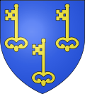 |
The arms of Hargnies are blazoned : Azure, 3 keys Or. (Floursies, Hargnies and Raismes use the same arms.)
|
See also[]
References[]
- ^ "Populations légales 2018". INSEE. 28 December 2020.
| Wikimedia Commons has media related to Hargnies (Nord). |
| show Authority control |
|---|
This Nord geographical article is a stub. You can help Wikipedia by . |
Categories:
- Communes of Nord (French department)
- Nord (French department) geography stubs