Englefontaine
Englefontaine | |
|---|---|
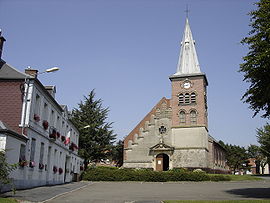 The church in Englefontaine | |
 Coat of arms | |
show Location of Englefontaine | |
 Englefontaine | |
| Coordinates: 50°11′32″N 3°38′37″E / 50.1922°N 3.6436°ECoordinates: 50°11′32″N 3°38′37″E / 50.1922°N 3.6436°E | |
| Country | France |
| Region | Hauts-de-France |
| Department | Nord |
| Arrondissement | Avesnes-sur-Helpe |
| Canton | Avesnes-sur-Helpe |
| Intercommunality | |
| Government | |
| • Mayor (2014-2020) | Michel Manesse |
| Area 1 | 4.62 km2 (1.78 sq mi) |
| Population (Jan. 2018)[1] | 1,293 |
| • Density | 280/km2 (720/sq mi) |
| Time zone | UTC+01:00 (CET) |
| • Summer (DST) | UTC+02:00 (CEST) |
| INSEE/Postal code | 59194 /59530 |
| Elevation | 128–152 m (420–499 ft) (avg. 135 m or 443 ft) |
| 1 French Land Register data, which excludes lakes, ponds, glaciers > 1 km2 (0.386 sq mi or 247 acres) and river estuaries. | |


Englefontaine is a commune in the Nord department in northern France.
Heraldry[]
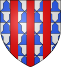 |
The arms of Englefontaine are blazoned : Vair, 3 pales gules. (Englefontaine, Louvignies-Quesnoy, Poix-du-Nord and Saint-Waast-la-Vallée use the same arms.)
|
See also[]
References[]
- ^ "Populations légales 2018". INSEE. 28 December 2020.
| Wikimedia Commons has media related to Englefontaine. |
| show Authority control |
|---|
This Nord geographical article is a stub. You can help Wikipedia by . |
Categories:
- Communes of Nord (French department)
- Nord (French department) geography stubs