Hérin
Hérin | |
|---|---|
 The town hall in Hérin | |
 Coat of arms | |
show Location of Hérin | |
 Hérin | |
| Coordinates: 50°21′19″N 3°27′11″E / 50.3553°N 3.4531°ECoordinates: 50°21′19″N 3°27′11″E / 50.3553°N 3.4531°E | |
| Country | France |
| Region | Hauts-de-France |
| Department | Nord |
| Arrondissement | Valenciennes |
| Canton | Aulnoy-lez-Valenciennes |
| Intercommunality | CA Porte du Hainaut |
| Government | |
| • Mayor (2020–2026) | Jean-Paul Comyn[1] |
| Area 1 | 4.48 km2 (1.73 sq mi) |
| Population (Jan. 2018)[2] | 4,128 |
| • Density | 920/km2 (2,400/sq mi) |
| Time zone | UTC+01:00 (CET) |
| • Summer (DST) | UTC+02:00 (CEST) |
| INSEE/Postal code | 59302 /59195 |
| Elevation | 36–115 m (118–377 ft) |
| 1 French Land Register data, which excludes lakes, ponds, glaciers > 1 km2 (0.386 sq mi or 247 acres) and river estuaries. | |


Hérin is a commune in the Nord department in northern France.
Heraldry[]
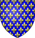 |
The arms of Hérin are blazoned : Azure, semy de lys Or. = France Ancient (Ansacq, Brillon, Escaudain, Escautpont, Hélesmes, Hérin, Lecelles, Lieu-Saint-Amand, Lourches, Neuville-sur-Escaut, Rosult, Rumegies and Wignehies use the same arms.)
|
See also[]
References[]
- ^ "Répertoire national des élus: les maires". data.gouv.fr, Plateforme ouverte des données publiques françaises (in French). 2 December 2020.
- ^ "Populations légales 2018". INSEE. 28 December 2020.
| Wikimedia Commons has media related to Hérin. |
| show Authority control |
|---|
This Nord geographical article is a stub. You can help Wikipedia by . |
Categories:
- Communes of Nord (French department)
- Nord (French department) geography stubs