Wylder
Wylder | |
|---|---|
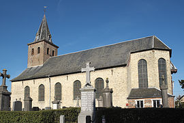 The church in Wylder | |
 Coat of arms | |
show Location of Wylder | |
 Wylder | |
| Coordinates: 50°54′48″N 2°29′36″E / 50.9133°N 2.4933°ECoordinates: 50°54′48″N 2°29′36″E / 50.9133°N 2.4933°E | |
| Country | France |
| Region | Hauts-de-France |
| Department | Nord |
| Arrondissement | Dunkerque |
| Canton | Wormhout |
| Intercommunality | Hauts de Flandre |
| Government | |
| • Mayor (2020–2026) | Catherine Clicteur[1] |
| Area 1 | 2.55 km2 (0.98 sq mi) |
| Population (Jan. 2018)[2] | 294 |
| • Density | 120/km2 (300/sq mi) |
| Demonym(s) | Wylderois (es) |
| Time zone | UTC+01:00 (CET) |
| • Summer (DST) | UTC+02:00 (CEST) |
| INSEE/Postal code | 59665 /59380 |
| Elevation | 6–22 m (20–72 ft) (avg. 15 m or 49 ft) |
| 1 French Land Register data, which excludes lakes, ponds, glaciers > 1 km2 (0.386 sq mi or 247 acres) and river estuaries. | |


Wylder is a commune in the Nord department in northern France.
The confluence of the Peene Becque and Yser rivers is located in Wylder.
Population[]
| Year | Pop. | ±% |
|---|---|---|
| 2006 | 311 | — |
| 2007 | 318 | +2.3% |
| 2008 | 319 | +0.3% |
| 2009 | 319 | +0.0% |
| 2010 | 320 | +0.3% |
| 2011 | 328 | +2.5% |
| 2012 | 330 | +0.6% |
| 2013 | 320 | −3.0% |
| 2014 | 309 | −3.4% |
| 2015 | 299 | −3.2% |
| 2016 | 295 | −1.3% |
Politics[]
Presidential Elections 2nd Round[]
| Election | Winning Candidate | Party | % | |
|---|---|---|---|---|
| 2017 | Marine Le Pen | FN | 69.59 | |
| 2012 | Nicolas Sarkozy | UMP | 61.24 | |
| 2007 | Nicolas Sarkozy | UMP | 59.67 | |
| 2002 | Jacques Chirac | RPR | 66.43 | |
Heraldry[]
 |
The arms of Wylder are blazoned : Argent, 5 hunting horns sable tied gules.
|
See also[]
References[]
- ^ "Répertoire national des élus: les maires". data.gouv.fr, Plateforme ouverte des données publiques françaises (in French). 2 December 2020.
- ^ "Populations légales 2018". INSEE. 28 December 2020.
- ^ http://www.lemonde.fr/data/france/presidentielle-2017//
| Wikimedia Commons has media related to Wylder. |
This Nord geographical article is a stub. You can help Wikipedia by . |
Categories:
- Communes of Nord (French department)
- Nord (French department) geography stubs