Escautpont
Escautpont | |
|---|---|
 The church square in Escautpont | |
 Coat of arms | |
show Location of Escautpont | |
 Escautpont | |
| Coordinates: 50°25′30″N 3°33′32″E / 50.425°N 3.559°ECoordinates: 50°25′30″N 3°33′32″E / 50.425°N 3.559°E | |
| Country | France |
| Region | Hauts-de-France |
| Department | Nord |
| Arrondissement | Valenciennes |
| Canton | Anzin |
| Intercommunality | CA Porte du Hainaut |
| Government | |
| • Mayor (2020–2026) | Joëlle Legrand |
| Area 1 | 5.78 km2 (2.23 sq mi) |
| Population (Jan. 2018)[1] | 4,173 |
| • Density | 720/km2 (1,900/sq mi) |
| Time zone | UTC+01:00 (CET) |
| • Summer (DST) | UTC+02:00 (CEST) |
| INSEE/Postal code | 59207 /59278 |
| Elevation | 17–41 m (56–135 ft) (avg. 28 m or 92 ft) |
| 1 French Land Register data, which excludes lakes, ponds, glaciers > 1 km2 (0.386 sq mi or 247 acres) and river estuaries. | |


Escautpont (French pronunciation: [ɛskopɔ̃]) is a commune in the Nord department in northern France.
Name[]
Escautpont is the bridge (pont in French) over the Escaut (Scheldt river). Named in antiquity Scaldis Pons (same meaning in Latin) because there was, at this place, the only bridge on the Scheldt.
Heraldry[]
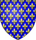 |
The arms of Escautpont are blazoned : Azure, semy de lys Or. = France Ancient (Ansacq, Brillon, Escaudain, Escautpont, Hélesmes, Hérin, Lecelles, Lieu-Saint-Amand, Lourches, Neuville-sur-Escaut, Rosult, Rumegies and Wignehies use the same arms.)
|
See also[]
References[]
- ^ "Populations légales 2018". INSEE. 28 December 2020.
| Wikimedia Commons has media related to Escautpont. |
This Nord geographical article is a stub. You can help Wikipedia by . |
Categories:
- Communes of Nord (French department)
- Nord (French department) geography stubs