Herrin, Nord
Herrin | |
|---|---|
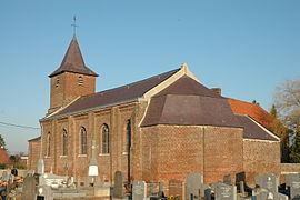 The church in Herrin | |
 Coat of arms | |
show Location of Herrin | |
 Herrin | |
| Coordinates: 50°32′50″N 2°57′58″E / 50.5472°N 2.9661°ECoordinates: 50°32′50″N 2°57′58″E / 50.5472°N 2.9661°E | |
| Country | France |
| Region | Hauts-de-France |
| Department | Nord |
| Arrondissement | Lille |
| Canton | Faches-Thumesnil |
| Intercommunality | Pévèle-Carembault |
| Government | |
| • Mayor (2020–2026) | Marcel Procureur[1] |
| Area 1 | 2.17 km2 (0.84 sq mi) |
| Population (Jan. 2018)[2] | 422 |
| • Density | 190/km2 (500/sq mi) |
| Time zone | UTC+01:00 (CET) |
| • Summer (DST) | UTC+02:00 (CEST) |
| INSEE/Postal code | 59304 /59147 |
| Elevation | 18–27 m (59–89 ft) (avg. 25 m or 82 ft) |
| 1 French Land Register data, which excludes lakes, ponds, glaciers > 1 km2 (0.386 sq mi or 247 acres) and river estuaries. | |


Herrin is a commune in the Nord department in northern France.
Heraldry[]
 |
The arms of Herrin are blazoned : Gules, a chief Or fretty sable.
|
See also[]
References[]
- ^ "Répertoire national des élus: les maires". data.gouv.fr, Plateforme ouverte des données publiques françaises (in French). 2 December 2020.
- ^ "Populations légales 2018". INSEE. 28 December 2020.
| Wikimedia Commons has media related to Herrin (France). |
This Nord geographical article is a stub. You can help Wikipedia by . |
Categories:
- Communes of Nord (French department)
- Nord (French department) geography stubs