Bermeries
Bermeries | |
|---|---|
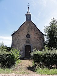 The chapel in Bermeries | |
 Coat of arms | |
show Location of Bermeries | |
 Bermeries | |
| Coordinates: 50°17′14″N 3°45′25″E / 50.2872°N 3.7569°ECoordinates: 50°17′14″N 3°45′25″E / 50.2872°N 3.7569°E | |
| Country | France |
| Region | Hauts-de-France |
| Department | Nord |
| Arrondissement | Avesnes-sur-Helpe |
| Canton | Aulnoye-Aymeries |
| Intercommunality | |
| Government | |
| • Mayor (2020–2026) | Jean-Claude Grossemy[1] |
| Area 1 | 5.29 km2 (2.04 sq mi) |
| Population (Jan. 2018)[2] | 372 |
| • Density | 70/km2 (180/sq mi) |
| Time zone | UTC+01:00 (CET) |
| • Summer (DST) | UTC+02:00 (CEST) |
| INSEE/Postal code | 59070 /59570 |
| Elevation | 113–153 m (371–502 ft) (avg. 126 m or 413 ft) |
| 1 French Land Register data, which excludes lakes, ponds, glaciers > 1 km2 (0.386 sq mi or 247 acres) and river estuaries. | |


Bermeries is a commune in the Nord department in northern France.
Population[]
|
|
Heraldry[]
 |
The arms of Bermeries are blazoned : Argent, a chief gules, overall a tree vert between 6 fish azure - the dexter 3 bendwise sinister, the sinister 3 bendwise.
|
See also[]
References[]
- ^ "Répertoire national des élus: les maires". data.gouv.fr, Plateforme ouverte des données publiques françaises (in French). 2 December 2020.
- ^ "Populations légales 2018". INSEE. 28 December 2020.
| Wikimedia Commons has media related to Bermeries. |
This Nord geographical article is a stub. You can help Wikipedia by . |
Categories:
- Communes of Nord (French department)
- Nord (French department) geography stubs