Émerchicourt
Émerchicourt | |
|---|---|
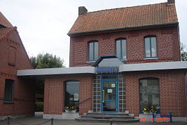 Town hall | |
 Coat of arms | |
show Location of Émerchicourt | |
 Émerchicourt | |
| Coordinates: 50°18′32″N 3°14′41″E / 50.3089°N 3.2447°ECoordinates: 50°18′32″N 3°14′41″E / 50.3089°N 3.2447°E | |
| Country | France |
| Region | Hauts-de-France |
| Department | Nord |
| Arrondissement | Valenciennes |
| Canton | Denain |
| Intercommunality | CA Porte du Hainaut |
| Government | |
| • Mayor (2014-2020) | Michel Loubert |
| Area 1 | 5.11 km2 (1.97 sq mi) |
| Population (Jan. 2018)[1] | 869 |
| • Density | 170/km2 (440/sq mi) |
| Time zone | UTC+01:00 (CET) |
| • Summer (DST) | UTC+02:00 (CEST) |
| INSEE/Postal code | 59192 /59580 |
| Elevation | 51–71 m (167–233 ft) (avg. 67 m or 220 ft) |
| 1 French Land Register data, which excludes lakes, ponds, glaciers > 1 km2 (0.386 sq mi or 247 acres) and river estuaries. | |


Émerchicourt is a commune in the Nord department in northern France.
Heraldry[]
 |
The arms of Émerchicourt are blazoned : Argent, a sow passant sable on a base vert. (Curgies and Émerchicourt use the same arms.)
|
See also[]
References[]
- ^ "Populations légales 2018". INSEE. 28 December 2020.
| Wikimedia Commons has media related to Émerchicourt. |
| show Authority control |
|---|
This Nord geographical article is a stub. You can help Wikipedia by . |
Categories:
- Communes of Nord (French department)
- Nord (French department) geography stubs