Masnières
Masnières | |
|---|---|
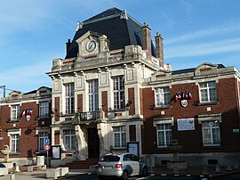 The town hall in Masnières | |
 Coat of arms | |
show Location of Masnières | |
 Masnières | |
| Coordinates: 50°06′57″N 3°12′38″E / 50.1158°N 3.2106°ECoordinates: 50°06′57″N 3°12′38″E / 50.1158°N 3.2106°E | |
| Country | France |
| Region | Hauts-de-France |
| Department | Nord |
| Arrondissement | Cambrai |
| Canton | Le Cateau-Cambrésis |
| Intercommunality | |
| Government | |
| • Mayor (2020–2026) | Francis Noblecourt |
| Area 1 | 10.97 km2 (4.24 sq mi) |
| Population (Jan. 2018)[1] | 2,731 |
| • Density | 250/km2 (640/sq mi) |
| Time zone | UTC+01:00 (CET) |
| • Summer (DST) | UTC+02:00 (CEST) |
| INSEE/Postal code | 59389 /59241 |
| Elevation | 54–119 m (177–390 ft) (avg. 62 m or 203 ft) |
| 1 French Land Register data, which excludes lakes, ponds, glaciers > 1 km2 (0.386 sq mi or 247 acres) and river estuaries. | |


Masnières (French pronunciation: [manjɛʁ]) is a commune in the Nord department in northern France.
Heraldry[]
 |
The arms of Masnières are blazoned: Azure, an inescutcheon between in orle 11 billets argent. (Ligny-en-Cambrésis, Masnières and Villers-au-Tertre use the same arms.)
|
History[]
Masnières figured into the 1917 Battle of Cambrai during which time it was briefly captured by the British on the first day of the battle, November 20, and held for twelve days to protect vital bridgeheads between Masnières and Marcoing before the British withdrawal under the weight of heavy German counter-attack.
The actions of the battle are commemorated in and around Masnières by several Commonwealth War Graves Commission landmarks in and around the town, including:
- Masnières Newfoundland Memorial
- Masnières British Cemetery
- Marcoing British Cemetery
See also[]
- Communes of the Nord department
- Marcel Gaumont. Sculpture on church
References[]
- ^ "Populations légales 2018". INSEE. 28 December 2020.
| Wikimedia Commons has media related to Masnières. |
| show Authority control |
|---|
This Nord geographical article is a stub. You can help Wikipedia by . |
- Communes of Nord (French department)
- Nord (French department) geography stubs