Baisieux
Baisieux | |
|---|---|
 The road into Baisieux | |
 Coat of arms | |
show Location of Baisieux | |
 Baisieux | |
| Coordinates: 50°36′33″N 3°15′11″E / 50.6092°N 3.2531°ECoordinates: 50°36′33″N 3°15′11″E / 50.6092°N 3.2531°E | |
| Country | France |
| Region | Hauts-de-France |
| Department | Nord |
| Arrondissement | Lille |
| Canton | Templeuve |
| Intercommunality | Métropole Européenne de Lille |
| Government | |
| • Mayor (2020–2026) | Philippe Limousin |
| Area 1 | 8.68 km2 (3.35 sq mi) |
| Population (Jan. 2018)[1] | 4,784 |
| • Density | 550/km2 (1,400/sq mi) |
| Time zone | UTC+01:00 (CET) |
| • Summer (DST) | UTC+02:00 (CEST) |
| INSEE/Postal code | 59044 /59780 |
| Elevation | 23–50 m (75–164 ft) (avg. 28 m or 92 ft) |
| 1 French Land Register data, which excludes lakes, ponds, glaciers > 1 km2 (0.386 sq mi or 247 acres) and river estuaries. | |


Baisieux is a commune in the Nord department, northern France.
It is part of the Métropole Européenne de Lille.
Population[]
|
|
Heraldry[]
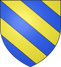 |
The arms of Baisieux are blazoned : Bendy Or and azure. (Baisieux, Bouvines and Cysoing use the same arms.)
|
See also[]
References[]
- ^ "Populations légales 2018". INSEE. 28 December 2020.
| Wikimedia Commons has media related to Baisieux. |

This Nord geographical article is a stub. You can help Wikipedia by . |
Categories:
- Communes of Nord (French department)
- Nord (French department) geography stubs