Beauvois-en-Cambrésis
Beauvois-en-Cambrésis | |
|---|---|
 The church in Beauvois-en-Cambrésis | |
 Coat of arms | |
show Location of Beauvois-en-Cambrésis | |
 Beauvois-en-Cambrésis | |
| Coordinates: 50°08′19″N 3°23′01″E / 50.1386°N 3.3836°ECoordinates: 50°08′19″N 3°23′01″E / 50.1386°N 3.3836°E | |
| Country | France |
| Region | Hauts-de-France |
| Department | Nord |
| Arrondissement | Cambrai |
| Canton | Caudry |
| Intercommunality | |
| Government | |
| • Mayor (2020-2026) | Yannick Herbet |
| Area 1 | 3.52 km2 (1.36 sq mi) |
| Population (Jan. 2018)[1] | 2,038 |
| • Density | 580/km2 (1,500/sq mi) |
| Time zone | UTC+01:00 (CET) |
| • Summer (DST) | UTC+02:00 (CEST) |
| INSEE/Postal code | 59063 /59157 |
| Elevation | 86–121 m (282–397 ft) |
| 1 French Land Register data, which excludes lakes, ponds, glaciers > 1 km2 (0.386 sq mi or 247 acres) and river estuaries. | |


Beauvois-en-Cambrésis is a commune in the Nord department in northern France.
Population[]
| Year | Pop. | ±% |
|---|---|---|
| 1793 | 626 | — |
| 1800 | 372 | −40.6% |
| 1806 | 483 | +29.8% |
| 1821 | 799 | +65.4% |
| 1831 | 913 | +14.3% |
| 1836 | 968 | +6.0% |
| 1841 | 1,060 | +9.5% |
| 1846 | 1,090 | +2.8% |
| 1851 | 1,051 | −3.6% |
| 1856 | 1,100 | +4.7% |
| 1861 | 1,307 | +18.8% |
| 1866 | 1,477 | +13.0% |
| 1872 | 1,959 | +32.6% |
| 1876 | 2,309 | +17.9% |
| 1881 | 3,333 | +44.3% |
| 1886 | 3,406 | +2.2% |
| 1891 | 3,878 | +13.9% |
| 1896 | 3,990 | +2.9% |
| 1901 | 3,986 | −0.1% |
| 1906 | 4,214 | +5.7% |
| 1911 | 4,105 | −2.6% |
| 1921 | 3,291 | −19.8% |
| 1926 | 3,071 | −6.7% |
| 1931 | 2,881 | −6.2% |
| 1936 | 2,759 | −4.2% |
| 1946 | 2,499 | −9.4% |
| 1954 | 2,548 | +2.0% |
| 1962 | 2,454 | −3.7% |
| 1968 | 2,286 | −6.8% |
| 1975 | 2,260 | −1.1% |
| 1982 | 2,258 | −0.1% |
| 1990 | 2,099 | −7.0% |
| 1999 | 1,994 | −5.0% |
| 2005 | 2,093 | +5.0% |
| 2006 | 2,104 | +0.5% |
| 2009 | 2,124 | +1.0% |
| 2010 | 2,143 | +0.9% |
| 2015 | 2,089 | −2.5% |
Heraldry[]
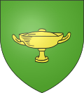 |
The arms of Beauvois-en-Cambrésis are blazoned : Vert, a covered cup Or.
|
See also[]
References[]
- ^ "Populations légales 2018". INSEE. 28 December 2020.
| Wikimedia Commons has media related to Beauvois-en-Cambrésis. |
| show Authority control |
|---|
This Nord geographical article is a stub. You can help Wikipedia by . |
Categories:
- Communes of Nord (French department)
- Nord (French department) geography stubs