Rumilly-en-Cambrésis
Rumilly-en-Cambrésis | |
|---|---|
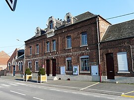 The town hall in Rumilly-en-Cambrésis | |
 Coat of arms | |
show Location of Rumilly-en-Cambrésis | |
 Rumilly-en-Cambrésis | |
| Coordinates: 50°07′39″N 3°13′15″E / 50.1275°N 3.2208°ECoordinates: 50°07′39″N 3°13′15″E / 50.1275°N 3.2208°E | |
| Country | France |
| Region | Hauts-de-France |
| Department | Nord |
| Arrondissement | Cambrai |
| Canton | Le Cateau-Cambrésis |
| Intercommunality | |
| Government | |
| • Mayor (2014-2020) | Michel Lienard |
| Area 1 | 6.76 km2 (2.61 sq mi) |
| Population (Jan. 2018)[1] | 1,444 |
| • Density | 210/km2 (550/sq mi) |
| Time zone | UTC+01:00 (CET) |
| • Summer (DST) | UTC+02:00 (CEST) |
| INSEE/Postal code | 59520 /59281 |
| Elevation | 64–106 m (210–348 ft) (avg. 68 m or 223 ft) |
| 1 French Land Register data, which excludes lakes, ponds, glaciers > 1 km2 (0.386 sq mi or 247 acres) and river estuaries. | |


Rumilly-en-Cambrésis is a commune in the Nord department in northern France.
Heraldry[]
 |
The arms of Rumilly-en-Cambrésis are blazoned : Or, 3 crescents gules. (Anneux, Crèvecœur-sur-l'Escaut, Rumilly-en-Cambrésis, Saint-Souplet and Wargnies-le-Petit use the same arms.)
|
See also[]
References[]
- ^ "Populations légales 2018". INSEE. 28 December 2020.
| Wikimedia Commons has media related to Rumilly-en-Cambrésis. |
This Nord geographical article is a stub. You can help Wikipedia by . |
Categories:
- Communes of Nord (French department)
- Nord (French department) geography stubs