Maurois
Maurois | |
|---|---|
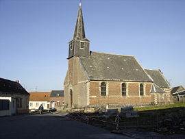 The church in Maurois | |
 Coat of arms | |
show Location of Maurois | |
 Maurois | |
| Coordinates: 50°04′21″N 3°28′01″E / 50.0725°N 3.4669°ECoordinates: 50°04′21″N 3°28′01″E / 50.0725°N 3.4669°E | |
| Country | France |
| Region | Hauts-de-France |
| Department | Nord |
| Arrondissement | Cambrai |
| Canton | Le Cateau-Cambrésis |
| Intercommunality | |
| Government | |
| • Mayor (2020-2026) | Bernadette Dupuis |
| Area 1 | 2.11 km2 (0.81 sq mi) |
| Population (Jan. 2018)[1] | 399 |
| • Density | 190/km2 (490/sq mi) |
| Time zone | UTC+01:00 (CET) |
| • Summer (DST) | UTC+02:00 (CEST) |
| INSEE/Postal code | 59394 /59980 |
| Elevation | 126–151 m (413–495 ft) |
| 1 French Land Register data, which excludes lakes, ponds, glaciers > 1 km2 (0.386 sq mi or 247 acres) and river estuaries. | |


Maurois is a commune in the Nord department in northern France.
Heraldry[]
 |
The arms of Maurois are blazoned : Azure, a lion argent within a bordure Or. (Maurois and Montigny-en-Cambrésis use the same arms.)
|
See also[]
References[]
- ^ "Populations légales 2018". INSEE. 28 December 2020.
| Wikimedia Commons has media related to Maurois (Nord). |
This Nord geographical article is a stub. You can help Wikipedia by . |
Categories:
- Communes of Nord (French department)
- Nord (French department) geography stubs