Avesnes-le-Sec
Avesnes-le-Sec | |
|---|---|
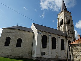 The church in Avesnes-le-Sec | |
 Coat of arms | |
show Location of Avesnes-le-Sec | |
 Avesnes-le-Sec | |
| Coordinates: 50°15′01″N 3°22′42″E / 50.2503°N 3.3783°ECoordinates: 50°15′01″N 3°22′42″E / 50.2503°N 3.3783°E | |
| Country | France |
| Region | Hauts-de-France |
| Department | Nord |
| Arrondissement | Valenciennes |
| Canton | Denain |
| Intercommunality | CA Porte du Hainaut |
| Government | |
| • Mayor (2020–2026) | Claude Regniez |
| Area 1 | 10.39 km2 (4.01 sq mi) |
| Population (Jan. 2018)[1] | 1,445 |
| • Density | 140/km2 (360/sq mi) |
| Time zone | UTC+01:00 (CET) |
| • Summer (DST) | UTC+02:00 (CEST) |
| INSEE/Postal code | 59038 /59296 |
| Elevation | 48–77 m (157–253 ft) (avg. 61 m or 200 ft) |
| 1 French Land Register data, which excludes lakes, ponds, glaciers > 1 km2 (0.386 sq mi or 247 acres) and river estuaries. | |


Avesnes-le-Sec (French pronunciation: [avɛn lə sɛk]) is a commune in the Nord department in northern France.
Population[]
|
|
Heraldry[]
 |
The arms of Avesnes-le-Sec are blazoned : Vert, a chevron between 3 mullets argent.
|
See also[]
References[]
- ^ "Populations légales 2018". INSEE. 28 December 2020.
| Wikimedia Commons has media related to Avesnes-le-Sec. |
| show Authority control |
|---|
This Nord geographical article is a stub. You can help Wikipedia by . |
Categories:
- Communes of Nord (French department)
- Nord (French department) geography stubs