Bellignies
Bellignies | |
|---|---|
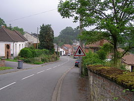 A view within Bellignies | |
 Coat of arms | |
show Location of Bellignies | |
 Bellignies | |
| Coordinates: 50°19′46″N 3°46′12″E / 50.3294°N 3.77°ECoordinates: 50°19′46″N 3°46′12″E / 50.3294°N 3.77°E | |
| Country | France |
| Region | Hauts-de-France |
| Department | Nord |
| Arrondissement | Avesnes-sur-Helpe |
| Canton | Aulnoye-Aymeries |
| Intercommunality | |
| Government | |
| • Mayor (2020–2026) | Danièle Druesnes[1] |
| Area 1 | 5.18 km2 (2.00 sq mi) |
| Population (Jan. 2018)[2] | 819 |
| • Density | 160/km2 (410/sq mi) |
| Time zone | UTC+01:00 (CET) |
| • Summer (DST) | UTC+02:00 (CEST) |
| INSEE/Postal code | 59065 /59570 |
| Elevation | 72–136 m (236–446 ft) (avg. 102 m or 335 ft) |
| 1 French Land Register data, which excludes lakes, ponds, glaciers > 1 km2 (0.386 sq mi or 247 acres) and river estuaries. | |


Bellignies is a commune in the Nord department in northern France.
Population[]
|
|
Heraldry[]
 |
The arms of Bellignies are blazoned : Quarterly 1&4: Or, 5 bendlets, and on a canton gules a mullet Or; 2&3 Chequy Or and gules (of 4 traits).
|
See also[]
References[]
- ^ "Répertoire national des élus: les maires". data.gouv.fr, Plateforme ouverte des données publiques françaises (in French). 2 December 2020.
- ^ "Populations légales 2018". INSEE. 28 December 2020.
| Wikimedia Commons has media related to Bellignies. |
| show Authority control |
|---|
This Nord geographical article is a stub. You can help Wikipedia by . |
Categories:
- Communes of Nord (French department)
- Nord (French department) geography stubs