Beugnies
Beugnies | |
|---|---|
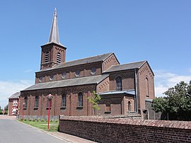 The church in Beugnies | |
 Coat of arms | |
show Location of Beugnies | |
 Beugnies | |
| Coordinates: 50°09′44″N 4°00′56″E / 50.1622°N 4.0156°ECoordinates: 50°09′44″N 4°00′56″E / 50.1622°N 4.0156°E | |
| Country | France |
| Region | Hauts-de-France |
| Department | Nord |
| Arrondissement | Avesnes-sur-Helpe |
| Canton | Fourmies |
| Intercommunality | |
| Government | |
| • Mayor (2014-2020) | Daniel Jopek |
| Area 1 | 8.92 km2 (3.44 sq mi) |
| Population (Jan. 2018)[1] | 630 |
| • Density | 71/km2 (180/sq mi) |
| Time zone | UTC+01:00 (CET) |
| • Summer (DST) | UTC+02:00 (CEST) |
| INSEE/Postal code | 59078 /59216 |
| Elevation | 179–219 m (587–719 ft) (avg. 192 m or 630 ft) |
| 1 French Land Register data, which excludes lakes, ponds, glaciers > 1 km2 (0.386 sq mi or 247 acres) and river estuaries. | |


Beugnies is a commune in the Nord department in northern France.
Population[]
| Year | Pop. | ±% |
|---|---|---|
| 1793 | 292 | — |
| 1800 | 334 | +14.4% |
| 1806 | 406 | +21.6% |
| 1821 | 441 | +8.6% |
| 1831 | 478 | +8.4% |
| 1836 | 481 | +0.6% |
| 1841 | 524 | +8.9% |
| 1846 | 518 | −1.1% |
| 1851 | 534 | +3.1% |
| 1856 | 530 | −0.7% |
| 1861 | 559 | +5.5% |
| 1866 | 553 | −1.1% |
| 1872 | 600 | +8.5% |
| 1876 | 629 | +4.8% |
| 1881 | 619 | −1.6% |
| 1886 | 698 | +12.8% |
| 1891 | 716 | +2.6% |
| 1896 | 737 | +2.9% |
| 1901 | 676 | −8.3% |
| 1906 | 684 | +1.2% |
| 1911 | 676 | −1.2% |
| 1921 | 631 | −6.7% |
| 1926 | 649 | +2.9% |
| 1931 | 692 | +6.6% |
| 1936 | 665 | −3.9% |
| 1946 | 638 | −4.1% |
| 1954 | 676 | +6.0% |
| 1962 | 702 | +3.8% |
| 1968 | 631 | −10.1% |
| 1975 | 555 | −12.0% |
| 1982 | 531 | −4.3% |
| 1990 | 509 | −4.1% |
| 1999 | 522 | +2.6% |
| 2005 | 497 | −4.8% |
| 2006 | 490 | −1.4% |
| 2009 | 552 | +12.7% |
| 2010 | 581 | +5.3% |
| 2015 | 628 | +8.1% |
Heraldry[]
 |
The arms of Beugnies are blazoned : Gules, 3 pales vair, and a chief Or. (Beugnies and Le Favril use the same arms.)
|
See also[]
References[]
- ^ "Populations légales 2018". INSEE. 28 December 2020.
| Wikimedia Commons has media related to Beugnies. |
| show Authority control |
|---|
This Nord geographical article is a stub. You can help Wikipedia by . |
Categories:
- Communes of Nord (French department)
- Nord (French department) geography stubs