Boulogne-sur-Helpe
Boulogne-sur-Helpe | |
|---|---|
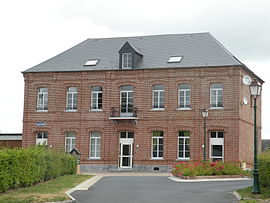 The town hall in Boulogne-sur-Helpe | |
 Coat of arms | |
show Location of Boulogne-sur-Helpe | |
 Boulogne-sur-Helpe | |
| Coordinates: 50°04′47″N 3°53′47″E / 50.0797°N 3.8964°ECoordinates: 50°04′47″N 3°53′47″E / 50.0797°N 3.8964°E | |
| Country | France |
| Region | Hauts-de-France |
| Department | Nord |
| Arrondissement | Avesnes-sur-Helpe |
| Canton | Avesnes-sur-Helpe |
| Intercommunality | |
| Government | |
| • Mayor (2014-2020) | Bernard Duflos |
| Area 1 | 8.7 km2 (3.4 sq mi) |
| Population (Jan. 2018)[1] | 340 |
| • Density | 39/km2 (100/sq mi) |
| Time zone | UTC+01:00 (CET) |
| • Summer (DST) | UTC+02:00 (CEST) |
| INSEE/Postal code | 59093 /59440 |
| Elevation | 144–207 m (472–679 ft) (avg. 177 m or 581 ft) |
| 1 French Land Register data, which excludes lakes, ponds, glaciers > 1 km2 (0.386 sq mi or 247 acres) and river estuaries. | |


Boulogne-sur-Helpe is a commune in the Nord department in northern France.
Population[]
| Year | Pop. | ±% |
|---|---|---|
| 1793 | 310 | — |
| 1800 | 346 | +11.6% |
| 1806 | 334 | −3.5% |
| 1821 | 359 | +7.5% |
| 1831 | 397 | +10.6% |
| 1836 | 411 | +3.5% |
| 1841 | 410 | −0.2% |
| 1846 | 418 | +2.0% |
| 1851 | 430 | +2.9% |
| 1856 | 468 | +8.8% |
| 1861 | 446 | −4.7% |
| 1866 | 438 | −1.8% |
| 1872 | 467 | +6.6% |
| 1876 | 455 | −2.6% |
| 1881 | 456 | +0.2% |
| 1886 | 474 | +3.9% |
| 1891 | 482 | +1.7% |
| 1896 | 450 | −6.6% |
| 1901 | 443 | −1.6% |
| 1906 | 441 | −0.5% |
| 1911 | 444 | +0.7% |
| 1921 | 425 | −4.3% |
| 1926 | 431 | +1.4% |
| 1931 | 404 | −6.3% |
| 1936 | 430 | +6.4% |
| 1946 | 415 | −3.5% |
| 1954 | 404 | −2.7% |
| 1962 | 406 | +0.5% |
| 1968 | 387 | −4.7% |
| 1975 | 346 | −10.6% |
| 1982 | 315 | −9.0% |
| 1990 | 319 | +1.3% |
| 1999 | 317 | −0.6% |
| 2006 | 322 | +1.6% |
| 2009 | 330 | +2.5% |
| 2011 | 325 | −1.5% |
| 2015 | 334 | +2.8% |
Heraldry[]
 |
The arms of Boulogne-sur-Helpe are blazoned : Argent, 3 fesses gules. (Boulogne-sur-Helpe and Petit-Fayt use the same arms.)
|
See also[]
References[]
- ^ "Populations légales 2018". INSEE. 28 December 2020.
| Wikimedia Commons has media related to Boulogne-sur-Helpe. |
| show Authority control |
|---|
This Nord geographical article is a stub. You can help Wikipedia by . |
Categories:
- Communes of Nord (French department)
- Nord (French department) geography stubs