Fournes-en-Weppes
Fournes-en-Weppes | |
|---|---|
 A general view of Fournes-en-Weppes | |
 Coat of arms | |
show Location of Fournes-en-Weppes | |
 Fournes-en-Weppes | |
| Coordinates: 50°35′09″N 2°53′24″E / 50.5858��N 2.89°ECoordinates: 50°35′09″N 2°53′24″E / 50.5858°N 2.89°E | |
| Country | France |
| Region | Hauts-de-France |
| Department | Nord |
| Arrondissement | Lille |
| Canton | Annœullin |
| Intercommunality | Métropole Européenne de Lille |
| Government | |
| • Mayor (2014-2020) | Daniel Herbaut |
| Area 1 | 8.22 km2 (3.17 sq mi) |
| Population (Jan. 2018)[1] | 2,225 |
| • Density | 270/km2 (700/sq mi) |
| Time zone | UTC+01:00 (CET) |
| • Summer (DST) | UTC+02:00 (CEST) |
| INSEE/Postal code | 59250 /59134 |
| Elevation | 26–43 m (85–141 ft) (avg. 43 m or 141 ft) |
| 1 French Land Register data, which excludes lakes, ponds, glaciers > 1 km2 (0.386 sq mi or 247 acres) and river estuaries. | |


Fournes-en-Weppes is a commune in the Nord department in northern France.
It is part of the Métropole Européenne de Lille. Hitler spent half of his war time service in World War I here.
Heraldry[]
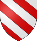 |
The arms of Fournes-en-Weppes are blazoned : Bendy argent and gules. (La Flamengrie, Fournes-en-Weppes and Wargnies-le-Grand use the same arms.)
|
See also[]
References[]
- ^ "Populations légales 2018". INSEE. 28 December 2020.
| Wikimedia Commons has media related to Fournes-en-Weppes. |

| show Authority control |
|---|
This Nord geographical article is a stub. You can help Wikipedia by . |
Categories:
- Communes of Nord (French department)
- Nord (French department) geography stubs