Le Maisnil
Le Maisnil | |
|---|---|
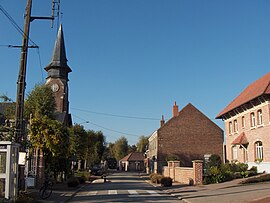 A view within Le Maisnil | |
 Coat of arms | |
show Location of Le Maisnil | |
 Le Maisnil | |
| Coordinates: 50°36′56″N 2°53′10″E / 50.6156°N 2.8861°ECoordinates: 50°36′56″N 2°53′10″E / 50.6156°N 2.8861°E | |
| Country | France |
| Region | Hauts-de-France |
| Department | Nord |
| Arrondissement | Lille |
| Canton | Annœullin |
| Intercommunality | Métropole Européenne de Lille |
| Government | |
| • Mayor (2020–2026) | Michel Borrewater[1] |
| Area 1 | 3.51 km2 (1.36 sq mi) |
| Population (Jan. 2018)[2] | 642 |
| • Density | 180/km2 (470/sq mi) |
| Time zone | UTC+01:00 (CET) |
| • Summer (DST) | UTC+02:00 (CEST) |
| INSEE/Postal code | 59371 /59134 |
| Elevation | 18–26 m (59–85 ft) (avg. 24 m or 79 ft) |
| 1 French Land Register data, which excludes lakes, ponds, glaciers > 1 km2 (0.386 sq mi or 247 acres) and river estuaries. | |


Le Maisnil is a commune in the Nord department in northern France.
It is about 10 km (6.2 mi) west of Lille.
Heraldry[]
 |
The arms of Le Maisnil are blazoned : Azure, an inescutcheon within 7 martlets in orle argent.
|
See also[]
References[]
- ^ "Répertoire national des élus: les maires". data.gouv.fr, Plateforme ouverte des données publiques françaises (in French). 2 December 2020.
- ^ "Populations légales 2018". INSEE. 28 December 2020.
| Wikimedia Commons has media related to Le Maisnil. |

| show Authority control |
|---|
This Nord geographical article is a stub. You can help Wikipedia by . |
Categories:
- Communes of Nord (French department)
- Nord (French department) geography stubs