Oudezeele
Oudezeele
Oudezele | |
|---|---|
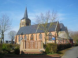 The church in Oudezeele | |
 Coat of arms | |
show Location of Oudezeele | |
 Oudezeele | |
| Coordinates: 50°50′20″N 2°30′36″E / 50.8389°N 2.51°ECoordinates: 50°50′20″N 2°30′36″E / 50.8389°N 2.51°E | |
| Country | France |
| Region | Hauts-de-France |
| Department | Nord |
| Arrondissement | Dunkerque |
| Canton | Wormhout |
| Intercommunality | Flandre Intérieure |
| Government | |
| • Mayor (2020–2026) | Jean-Luc Debert[1] |
| Area 1 | 9.36 km2 (3.61 sq mi) |
| Population (Jan. 2018)[2] | 681 |
| • Density | 73/km2 (190/sq mi) |
| Demonym(s) | Oudezeelois (es) |
| Time zone | UTC+01:00 (CET) |
| • Summer (DST) | UTC+02:00 (CEST) |
| INSEE/Postal code | 59453 /59670 |
| Elevation | 16–47 m (52–154 ft) (avg. 10 m or 33 ft) |
| 1 French Land Register data, which excludes lakes, ponds, glaciers > 1 km2 (0.386 sq mi or 247 acres) and river estuaries. | |


Oudezeele (from Flemish; Oudezele in modern Dutch spelling) is a commune in the Nord department in northern France. It is around 45 km north-west of Lille. The population is 681 (as of 2018).
Politics[]
Presidential Elections 2nd Round[]
| Election | Winning Candidate | Party | % | |
|---|---|---|---|---|
| 2017 | Emmanuel Macron | En Marche! | 53.23 | |
| 2012 | Nicolas Sarkozy | UMP | 60.20 | |
| 2007 | Nicolas Sarkozy | UMP | 62.20 | |
| 2002 | Jacques Chirac | RPR | 70.11 | |
Heraldry[]
 |
The arms of Oudezeele are blazoned : Argent, 3 horns sable tied gules. (Hardifort, Merris and Oudezeele use the same arms.)
|
See also[]
References[]
- ^ "Répertoire national des élus: les maires". data.gouv.fr, Plateforme ouverte des données publiques françaises (in French). 2 December 2020.
- ^ "Populations légales 2018". INSEE. 28 December 2020.
- ^ http://www.lemonde.fr/data/france/presidentielle-2017//
| Wikimedia Commons has media related to Oudezeele. |
| show Authority control |
|---|
This Nord geographical article is a stub. You can help Wikipedia by . |
Categories:
- Communes of Nord (French department)
- Nord (French department) geography stubs