Robersart
Robersart | |
|---|---|
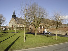 A view within Robersart | |
 Coat of arms | |
show Location of Robersart | |
 Robersart | |
| Coordinates: 50°09′27″N 3°38′39″E / 50.1575°N 3.6442°ECoordinates: 50°09′27″N 3°38′39″E / 50.1575°N 3.6442°E | |
| Country | France |
| Region | Hauts-de-France |
| Department | Nord |
| Arrondissement | Avesnes-sur-Helpe |
| Canton | Avesnes-sur-Helpe |
| Intercommunality | |
| Government | |
| • Mayor (2014-2020) | André Jacquinet |
| Area 1 | 2.33 km2 (0.90 sq mi) |
| Population (Jan. 2018)[1] | 191 |
| • Density | 82/km2 (210/sq mi) |
| Time zone | UTC+01:00 (CET) |
| • Summer (DST) | UTC+02:00 (CEST) |
| INSEE/Postal code | 59503 /59550 |
| Elevation | 139–166 m (456–545 ft) (avg. 150 m or 490 ft) |
| 1 French Land Register data, which excludes lakes, ponds, glaciers > 1 km2 (0.386 sq mi or 247 acres) and river estuaries. | |


Robersart is a commune in the Nord department in northern France.
Heraldry[]
 |
The arms of Robersart are blazoned : Vert, a lion Or, armed and langued gules. (Ribécourt-la-Tour and Robersart use the same arms.)
|
See also[]
References[]
- ^ "Populations légales 2018". INSEE. 28 December 2020.
| Wikimedia Commons has media related to Robersart. |
| show Authority control |
|---|
This Nord geographical article is a stub. You can help Wikipedia by . |
Categories:
- Communes of Nord (French department)
- Nord (French department) geography stubs