Saulzoir
Saulzoir | |
|---|---|
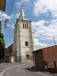 The church in Saulzoir | |
 Coat of arms | |
show Location of Saulzoir | |
 Saulzoir | |
| Coordinates: 50°14′29″N 3°26′41″E / 50.2414°N 3.4447°ECoordinates: 50°14′29″N 3°26′41″E / 50.2414°N 3.4447°E | |
| Country | France |
| Region | Hauts-de-France |
| Department | Nord |
| Arrondissement | Cambrai |
| Canton | Caudry |
| Intercommunality | |
| Government | |
| • Mayor (2020-2026) | Gilbert Gernet |
| Area 1 | 10.1 km2 (3.9 sq mi) |
| Population (Jan. 2018)[1] | 1,720 |
| • Density | 170/km2 (440/sq mi) |
| Time zone | UTC+01:00 (CET) |
| • Summer (DST) | UTC+02:00 (CEST) |
| INSEE/Postal code | 59558 /59227 |
| Elevation | 43–88 m (141–289 ft) (avg. 65.5 m or 215 ft) |
| 1 French Land Register data, which excludes lakes, ponds, glaciers > 1 km2 (0.386 sq mi or 247 acres) and river estuaries. | |


Saulzoir is a commune in the Nord department in northern France.
It is situated on the Selle River and has about 1700 inhabitants (1999 census). The town was the site of Julius Caesar's battle against the Nervians.[2]
Heraldry[]
 |
The arms of Saulzoir are blazoned : Azure, a crescent between 11 billets (in chief in fess 5, in base 3,2,1) Or.
|
See also[]
References[]
- ^ "Populations légales 2018". INSEE. 28 December 2020.
- ^ Pierre Turquin ("La Bataille de la Selle (du Sabis) en l' An 57 avant J.-C." in Les Études Classiques 23/2 (1955), 113-156) has proved beyond reasonable doubt that the battle was fought at the River Selle.
| Wikimedia Commons has media related to Saulzoir. |
| show Authority control |
|---|
This Nord geographical article is a stub. You can help Wikipedia by . |
Categories:
- Communes of Nord (French department)
- Nord (French department) geography stubs