Waziers
Waziers | |
|---|---|
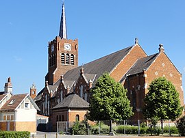 The church in Waziers | |
 Coat of arms | |
show Location of Waziers | |
 Waziers | |
| Coordinates: 50°23′13″N 3°06′47″E / 50.387°N 3.113°ECoordinates: 50°23′13″N 3°06′47″E / 50.387°N 3.113°E | |
| Country | France |
| Region | Hauts-de-France |
| Department | Nord |
| Arrondissement | Douai |
| Canton | Sin-le-Noble |
| Intercommunality | Douaisis Agglo |
| Government | |
| • Mayor (2020-2026) | Laurent Desmons |
| Area 1 | 4.34 km2 (1.68 sq mi) |
| Population (Jan. 2018)[1] | 7,427 |
| • Density | 1,700/km2 (4,400/sq mi) |
| Time zone | UTC+01:00 (CET) |
| • Summer (DST) | UTC+02:00 (CEST) |
| INSEE/Postal code | 59654 /59119 |
| Elevation | 17–27 m (56–89 ft) (avg. 27 m or 89 ft) |
| 1 French Land Register data, which excludes lakes, ponds, glaciers > 1 km2 (0.386 sq mi or 247 acres) and river estuaries. | |


Waziers is a commune in the Nord department in northern France.
It is 4 km (2.5 mi) northwest of Douai and 25 km (16 mi) south of Lille.
Heraldry[]
 |
The arms of Waziers are blazoned : Azure, a inescutcheon argent, overall a bend gules.
|
Population[]
| Year | Pop. | ±% |
|---|---|---|
| 2006 | 7,720 | — |
| 2007 | 7,686 | −0.4% |
| 2008 | 7,651 | −0.5% |
| 2009 | 7,617 | −0.4% |
| 2010 | 7,615 | −0.0% |
| 2011 | 7,710 | +1.2% |
| 2012 | 7,639 | −0.9% |
| 2013 | 7,568 | −0.9% |
| 2014 | 7,497 | −0.9% |
| 2015 | 7,498 | +0.0% |
| 2016 | 7,477 | −0.3% |
See also[]
References[]
- ^ "Populations légales 2018". INSEE. 28 December 2020.
| Wikimedia Commons has media related to Waziers. |
| show Authority control |
|---|
This Nord geographical article is a stub. You can help Wikipedia by . |
Categories:
- Communes of Nord (French department)
- Nord (French department) geography stubs