Willies, Nord
Willies | |
|---|---|
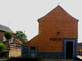 The town hall in Willies | |
 Coat of arms | |
show Location of Willies | |
 Willies | |
| Coordinates: 50°07′18″N 4°05′56″E / 50.1217°N 4.0989°ECoordinates: 50°07′18″N 4°05′56″E / 50.1217°N 4.0989°E | |
| Country | France |
| Region | Hauts-de-France |
| Department | Nord |
| Arrondissement | Avesnes-sur-Helpe |
| Canton | Fourmies |
| Intercommunality | |
| Government | |
| • Mayor (2014-2020) | Laurent Méresse |
| Area 1 | 4.14 km2 (1.60 sq mi) |
| Population (Jan. 2018)[1] | 142 |
| • Density | 34/km2 (89/sq mi) |
| Time zone | UTC+01:00 (CET) |
| • Summer (DST) | UTC+02:00 (CEST) |
| INSEE/Postal code | 59661 /59740 |
| Elevation | 162–230 m (531–755 ft) (avg. 168 m or 551 ft) |
| 1 French Land Register data, which excludes lakes, ponds, glaciers > 1 km2 (0.386 sq mi or 247 acres) and river estuaries. | |


Willies is a commune in the Nord department in northern France. It is 10 km (6.2 mi) southeast of Maubeuge.
Heraldry[]
 |
The arms of Willies are blazoned : Gules, 2 fesses embattled counterembattled argent, overall on a canton Gules, 3 pales vair and a chief Or. (Baives and Willies use the same arms.)
|
Population[]
| Year | Pop. | ±% |
|---|---|---|
| 2006 | 143 | — |
| 2007 | 150 | +4.9% |
| 2008 | 158 | +5.3% |
| 2009 | 165 | +4.4% |
| 2010 | 166 | +0.6% |
| 2011 | 165 | −0.6% |
| 2012 | 162 | −1.8% |
| 2013 | 159 | −1.9% |
| 2014 | 156 | −1.9% |
| 2015 | 155 | −0.6% |
| 2016 | 154 | −0.6% |
See also[]
References[]
- ^ "Populations légales 2018". INSEE. 28 December 2020.
| Wikimedia Commons has media related to Willies. |
| show Authority control |
|---|
This Nord geographical article is a stub. You can help Wikipedia by . |
Categories:
- Communes of Nord (French department)
- Nord (French department) geography stubs